
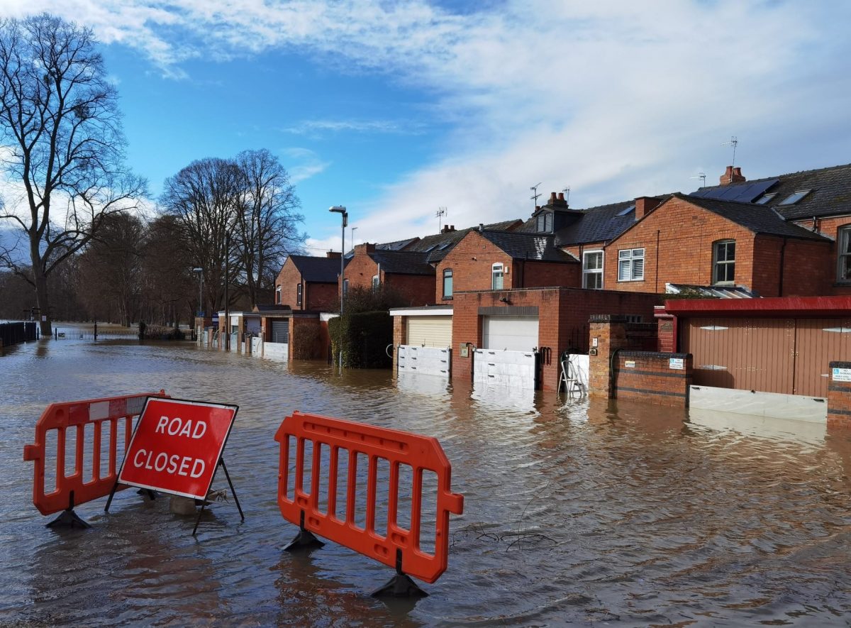
Major flooding events have become part of our weather culture. Every year we see the dramatic and often tragic consequences and economic losses of wide area flooding. In the battle with climate change, surveyors have a vital contribution to make providing the accurate maps and plans upon which hydrologists and engineers depend for their computer models and engineering designs.
To meet the challenge, the TSA’s Survey School expanded its syllabus with the addition of an inland hydrospatial/hydrography module specifically designed to provide land surveyors (who undertake much of the inland water-related survey works) with a sound grasp of the necessary principles.
In the following guest blog, Edwin Danson;- Chartered Surveyor, TSA Survey School, delves further into the school’s hydrospatial course that addresses the key differentiators between inland water body hydrospatial surveying, land surveying and coastal/offshore (hydrographic) surveys.
The consequences of climate change and rising sea levels offers an unprecedented challenge for enthusing politicians to one of the most important keys to winning the battle – better and more regular mapping of a fast-changing environment. Vital though they are, it is going to take more than home insulation, electric cars, greening-up energy solutions, and changing lifestyles if we are to win through. Agriculture and deforestation accounts for a third of greenhouse gas production, yet realistically changing farming and forestry methods across the globe, especially in the less affluent nations, is a tall order.
For engineers, perhaps one of the greatest challenges is water management – delivering water where it’s needed during droughts, and dissipating water in times of storm and flood. The amount of radical engineering solutions that will be necessary to protect our way of life are seldom discussed, but are inevitable – we delude ourselves if we believe this is not the case. It is too late for holistic life-style changes alone to save our planet, vital and critical as they are.
An IPCC press release in August 2021 stated that climate change is intensifying the water cycle bringing “more intense rainfall and associated flooding, as well as more intense drought in many regions”. Precipitation will increase in high latitudes while decreasing over the subtropics. “Coastal areas will see continued sea level rise throughout the 21st century, contributing to more frequent and severe coastal flooding in low-lying areas and coastal erosion. A recent report concluded that flooding is exacerbated by changes in land use, urbanisation, the widespread use of impermeable surfacing such as asphalt and concrete for drives and carparks, and inadequate local and national government planning policies.
Major flooding events have already become accepted in the public mind as part of our weather culture. Every year the dramatic and often tragic consequences, the economic losses, and the social misery fills our TV screens.
In the long and difficult climate change battle, however and wherever it’s fought, geomatics specialists have the critically essential role supplying the all-important maps, plans, digital models and data streams upon which hydrologists, engineers, climatologists, emergency services and all those involved in saving the planet depend. In particular, the specialist skills of the hydrospatial surveyor are increasingly important in a swiftly changing environment and in a marketplace already short of the specialist skills for accurately mapping nearshore and inland waters.
While many of the hydrospatial tools are those familiar in the offshore environment, when it comes to their use for surveying inland watercourses, rivers, lakes, canals and reservoirs, their employment demands specialist application skills and knowledge. Positioning the acquisition platforms, for example, is a particular challenge in forested areas, along sinuous river courses and through urban and industrial environments where water courses and canals tend to occupy the urban canyon depths, subterranean waterways, tunnels and culverts.
The hydrospatial surveyor also has to deal with a range of water related variables and changing environmental conditions. River weed and plant material, fallen trees, detritus, the ubiquitous shopping trolly, and dumped cars are ever-present threats to survey sensors and underwater equipment. Increasing water temperatures, prevalence of storm events and changes in rainfall patterns all have catastrophic effects on rivers and other freshwater bodies. Rising temperatures slow the oxygen production processes creating lifeless “dead zones”, toxic algal blooms and poisoned waterways. Extreme flooding events lead to raw sewerage overflow (often as a deliberate result of water management policy), increased and unconstrained surface water runoff heavy with industrial pollutants or agricultural nutrients, contaminating rivers, increasing toxic threats and waterborne diseases, killing plants and wildlife.
The need for the expert survey skills of the inland hydrospatial surveyor can only increase as governments and local authorities come to grips with the reality of delivering long-term flood management solutions. In the UK, where surveying and mapping is an unregulated activity, the majority of inland water bodies falls within the sphere of the land geomatics professional.
Until recently, there were no specific courses addressing the necessary skills’ upgrade paths until the UK Survey Association’s Survey School in Worcester included among its range of specialist courses a hydrospatial course that builds on the extant surveying skills and knowledge of practicing land surveyors, final year students, and engineers. The course focuses on the addressing the key differentiators between inland water body hydrospatial surveying, land surveying and coastal/offshore (hydrographic) surveys.
Where apposite, among the cited specifications and best practice documentation in the course is included the UK’s Environment Agency’s requirements, chiefly focused towards flooding models, and the Marine and Coastguard Agency’s specification where this arises in connection with engineering in tidal zones.
Find out more on the TSA’s Survey School and its excellent range of specialist courses.
 Edwin Danson FRICS FCInstCES began his career in the public / civil engineering surveying sector before moving into the marine geospatial and environmental fields. He has held senior and executive positions with some of the world’s leading international land, geophysical and hydrographic survey companies as well as his own consultancy firm of Swan Consultants Ltd.
He is a Fellow of the Royal Institution of Chartered Surveyors, and a Fellow and Past President of the Chartered Institution of Civil Engineering Surveyors. He has some 60 published papers and articles on aspects of hydrography and geospatial engineering to his name and is the author of narrative history books and papers on early surveying science.