

Where geospatial powers infrastructure, cities, and decisions: WGIC Horizons 2026 comes to London
Where geospatial powers infrastructure, cities, and decisions: WGIC Horizons…


OXTS joins the fight against poaching in Africa
It’s one thing to talk about best practices for mobile mappers; it’s another…


Terra Drone partners with Pythagoras to launch “Terra 3D CAD”
Terra Drone partners with Pythagoras to launch “Terra 3D CAD”Pythagoras BV and…

AGI Awards 2026 celebrate excellence in geospatial with new categories
The GEO Business team is delighted to partner once again with The Association…
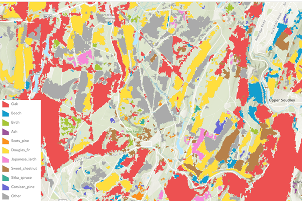
New remote sensing products from Defra's NCEA programme
Spotlight on new innovative remote sensing products from Defra’s Natural…


Manchester University NHS Foundation Trust creates smart estate with digital twin
GIS from Esri UK supports digital transformation at one of UK’s largest NHS…

New report urges immediate action to realise the value of location intelligence
A new report that reveals the challenges and opportunities facing the…

AGI foresight conference challenges geospatial community to transition
A first of its kind event for the UK, The Association for Geographic…
RICS launches landmark global standard on responsible use of AI in surveying
The Royal Institution of Chartered Surveyors (RICS) has published the first…