
Clirio, Inc. today announces a complete reengineering of its geospatial data visualization tool (formerly known as the ‘Ada Platform’). The new application, branded simply as ‘Clirio’, includes built-in 3D photogrammetry scanning, an entirely new, intuitive, map-based interface, and the ability to geo-reference elements that will offer our customers an end-to-end solution to capture, organize and share their field notes and data. The new Clirio app will also include their well-regarded Remote Collaboration technology that allows teams and other stakeholders to share and collaborate on data in a virtual environment, from anywhere in the world.
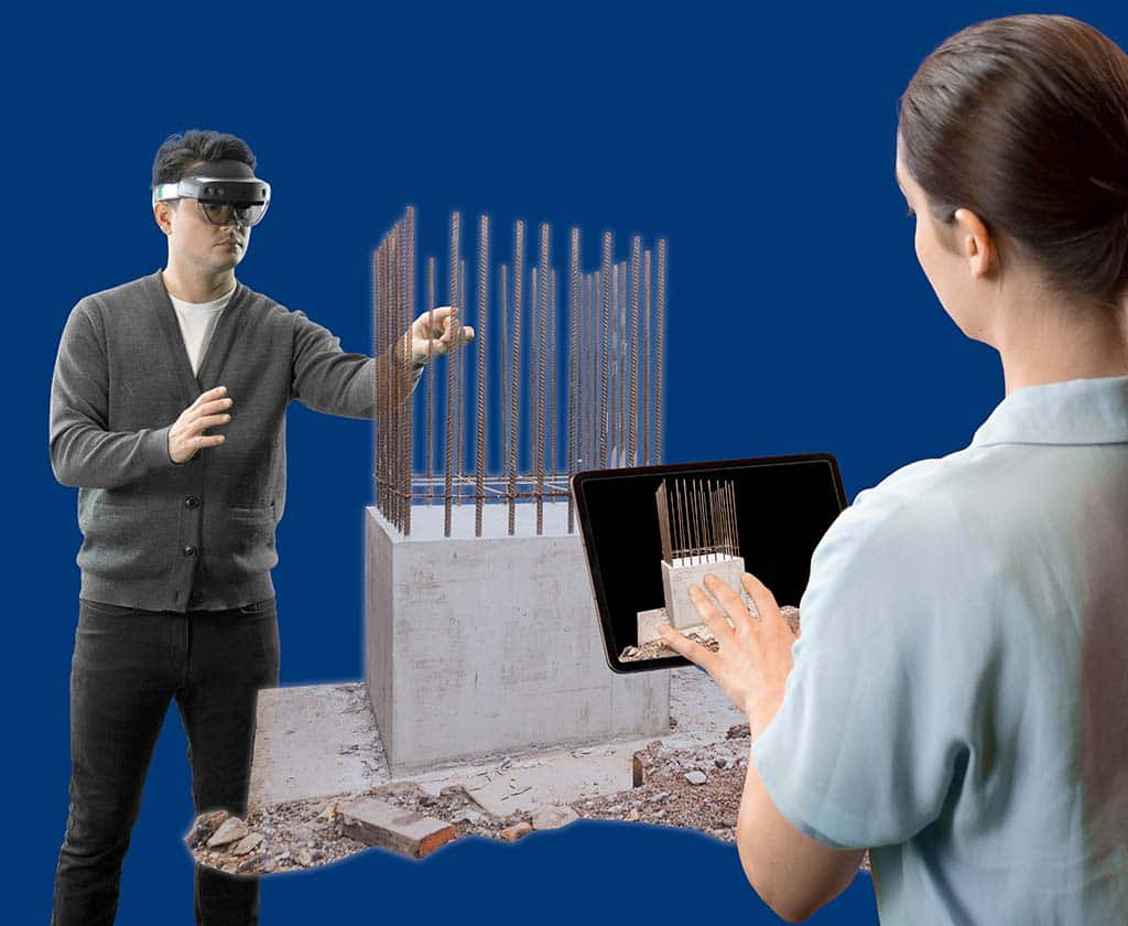

Clirio is a mobile app for instantly capturing, sharing, reviewing, and resolving worksite field observations, issues, or updates. Clirio users employ the app to collect notes, photos and even 3D scans (using the laser scanner built into a new iPad or iPhone Pro). These field observations are automatically geo-referenced within the map-based workspace and stored in a secure cloud database. An intuitive interface allows colleagues, managers, contractors or stakeholders to sort, review, compare and action field observations. Other data types (such as large-scale photogrammetry, LiDAR, CAD, and subsurface data) can also be added to the workspace. Teams can collaborate as a group in a live, remote, virtual holographic meeting around one or more 3D scans from within the app. Clirio accurately documents a “digital twin” of observations as the worksite evolves over time, letting users revisit the site’s current or historical points of interest from anywhere at any time.
The collaboration capabilities use augmented reality on the iPhones and iPads that many clients have already. For a true 3D holographic experience, Clirio offers a viewer for Microsoft HoloLens devices, with Oculus Quest VR support to follow. Multiple users with mixed devices can join a virtual session around the 3D data, either in the same physical space, or remotely from anywhere in the world.
“We have had such excellent enthusiasm and input from our customers using our existing software to create holographic visualizations of their spatial data. Building from that, we are excited to launch a whole new suite of tools to help our customers succeed with their field data capture, organization and sharing challenges,” says Clirio CEO Ron Klopfer. “Having worked with diverse clients across mining, infrastructure, oil and gas, construction and government has given us the insight and confidence to bring this new app to market.”
“Our experience with Clirio’s technology has changed the way we view and work with 3D spatial data. We are very much looking forward to the opportunity to capture notes and scans directly in the field and share them quickly with the experts and decision makers in our organization to reduce bottlenecks and roadblocks on our projects” says Bill Burton, VP of Engineering for BGC Engineering Inc.
The new Clirio app is available in private beta for select users. To apply for the private beta, go to www.clir.io/beta.
Meet Clirio Inc at GEO Business 2021

About Clirio Inc
Supercharge your team’s field inspection accuracy and efficiency via easy capture of georeferenced images, notes and 3D LiDAR scans, with the Clirio app. Take command over your scattered field data with Clirio’s map-based Site Information Management system (SIM) and “walk the site” at any time to review geo- and timeline- referenced observations with a sense of time and place. Collaborate with team members, experts, and stakeholders, regardless of their location, and move projects forward with the incredible holographic visualization capabilities of Clirio.