
Loading view.
2026
Programme
Select Theatres
⌄
Week of Sessions
<<
>>
10:00
11:00
12:00
13:00
14:00
15:00
16:00
17:00
Built Environment Stage

Making data work: Accessibility as the foundation of smarter housing and infrastructure
Data only delivers value when it can be found, trusted, and used at the moment decisions are made. This session explores how moving beyond interoperability to true data accessibility unlocks better outcomes across planning, housing, and the built environment. You’ll learn how federated discovery, trust, quality, and real-time access work together to turn data into actionable insight – and why accessibility is fast becoming the real competitive advantage. Attend to gain practical ideas you can apply immediately to make your data easier to use, easier to trust, and far more valuable.
Read More >>Looking up! A drone perspective
10:00 - 10:30
C2D is the drone community for drones in construction and infrastructure sector. We work with some of the UK's biggest critical national infrastructure organisations, top construction companies and fantastic commercial drone operators and specialists.
We are sharing this, because we have been working with them to bring you lots of great real-life case studies to help support our awareness campaign and this presentation.
Looking up! A drone perspective is about the construction industry and its long-standing battle with poor productivity. It's about its difficulties of solving that through technology adoption. It is framed in a sector, where safety is paramount.
Hence, we will be looking at this through the prism of working at height. The most common cause of work fatalities in the UK. Whilst exploring are drones safe.
All this before we 'take off' and cover multiple case studies from our members highlighted traditional methods against drone operational case studies that range right across the construction and infrastructure sector. Showcasing how drones are often faster, cheaper and most importantly safer than traditional methods.
And after all that we will reveal what our members' number one barrier to drone adoption is. You may be surprised! It might be worth looking up after all.
Speakers:

Anthony Shooter
C2D
Director
Looking up! A drone perspective
C2D is the drone community for drones in construction and infrastructure sector. We work with some of the UK's biggest critical national infrastructure organisations, top construction companies and fantastic commercial drone operators and specialists. We are sharing this, because we have been working with them to bring you lots of great real-life case studies to help support our awareness campaign and this presentation. Looking up! A drone perspective is about the construction industry and its long-standing battle with poor productivity. It's about its difficulties of solving that through technology adoption. It is framed in a sector, where safety is paramount. Hence, we will be looking at this through the prism of working at height. The most common cause of work fatalities in the UK. Whilst exploring are drones safe. All this before we 'take off' and cover multiple case studies from our members highlighted traditional methods against drone operational case studies that range right across the construction and infrastructure sector. Showcasing how drones are often faster, cheaper and most importantly safer than traditional methods. And after all that we will reveal what our members' number one barrier to drone adoption is. You may be surprised! It might be worth looking up after all.
Read More >>Speakers:
Anthony Shooter
C2D
Director
Artificial intelligence and geospatial analysis to indicate locations in Brazilian real estate market
15:30 - 16:00
The presentation shows the development of a machine learning model applied to geospatial analyses using real estate market data in Brazil. In addition to showing the challenges and opportunities of the Brazilian territory, the presentation will explain how this prototype was validated in the evaluation of areas and land for the real estate market. It was the first time an automated model focused not only on providing geospatial market data, but also on automating key geospatial analyses, was applied in Brazil, at the headquarters of Linkages Geoespacial. The learning process generates insights, reducing user time and resources. The solution expands, optimises, and offers access and support, at the cartographic level and in real time, for decision-making by market players and new Brazilian entrepreneurs.
Speakers:

Dr Lucas Baldoni
Linkages
Founder
Artificial intelligence and geospatial analysis to indicate locations in Brazilian real estate market
The presentation shows the development of a machine learning model applied to geospatial analyses using real estate market data in Brazil. In addition to showing the challenges and opportunities of the Brazilian territory, the presentation will explain how this prototype was validated in the evaluation of areas and land for the real estate market. It was the first time an automated model focused not only on providing geospatial market data, but also on automating key geospatial analyses, was applied in Brazil, at the headquarters of Linkages Geoespacial. The learning process generates insights, reducing user time and resources. The solution expands, optimises, and offers access and support, at the cartographic level and in real time, for decision-making by market players and new Brazilian entrepreneurs.
Read More >>Speakers:
Dr Lucas Baldoni
Linkages
Founder

World first: Fully autonomous UAV inspection in a GPS-denied dam tunnel
No GPS. No signal. No pilot. At GeoBusiness, hear how a world-first fully autonomous UAV inspection was successfully completed at Ladybower Reservoir. An Emesent Hovermap mounted on a DJI Matrice 350 RTK flew 240 m into a dam tunnel and returned completely autonomously, with zero pilot input. This session shows what’s now possible in GPS-denied, confined environments and why autonomy is a game-changer for inspection, safety, and access. From tunnels and industrial plants to underground infrastructure and emergency response, this is a real deployment that signals where UAV operations are heading next.
Read More >>From spreadsheets to spatial safety: Creating a golden thread for CDM risk
13:30 - 14:00
Discover how a GIS-powered CDM system can replace disconnected spreadsheets with a live, spatial “golden thread” of hazard information.
This session shows how integrating CDM risk workflows with Civil3D, Revizto and ISO 19650‑6 standards creates better compliance, better collaboration and better safety outcomes. Join us to see what the future of digital CDM really looks like.
Speakers:

Matt Banyard
AtkinsRéalis
Senior GIS Consultant

Rachel Stewart
AtkinsRéalis
GIS Consultant
From spreadsheets to spatial safety: Creating a golden thread for CDM risk
Discover how a GIS-powered CDM system can replace disconnected spreadsheets with a live, spatial “golden thread” of hazard information. This session shows how integrating CDM risk workflows with Civil3D, Revizto and ISO 19650‑6 standards creates better compliance, better collaboration and better safety outcomes. Join us to see what the future of digital CDM really looks like.
Read More >>How to retain your talent
16:30 - 17:00
Marc Rowley delivers straight-talking keynote sessions that challenge leaders to rethink how they keep their best people. Drawing on more than 30 years of senior leadership experience, Marc focuses on what actually drives retention, not slogans or perks.
In his session, How to retain your talent, Marc explores why people really stay, why they leave, and what leaders do that quietly pushes talent out the door. He tackles motivation, inclusion, values-based recruitment, and the realities of leading multigenerational teams. Every point links back to daily leadership behaviour, not policy documents.
Audiences leave with clear actions they can take immediately to reduce turnover, build trust, and create workplaces where people choose to stay, grow, and perform. Marc’s style is practical, honest, and grounded in real organisational life, making his sessions highly relevant for senior leaders, HR teams, and people managers who want results, not theory.
Speakers:

Marc Rowley
HIT Leadership
CEO
How to retain your talent
Marc Rowley delivers straight-talking keynote sessions that challenge leaders to rethink how they keep their best people. Drawing on more than 30 years of senior leadership experience, Marc focuses on what actually drives retention, not slogans or perks. In his session, How to retain your talent, Marc explores why people really stay, why they leave, and what leaders do that quietly pushes talent out the door. He tackles motivation, inclusion, values-based recruitment, and the realities of leading multigenerational teams. Every point links back to daily leadership behaviour, not policy documents. Audiences leave with clear actions they can take immediately to reduce turnover, build trust, and create workplaces where people choose to stay, grow, and perform. Marc’s style is practical, honest, and grounded in real organisational life, making his sessions highly relevant for senior leaders, HR teams, and people managers who want results, not theory.
Read More >>Speakers:
Marc Rowley
HIT Leadership
CEO

Measuring a London landmark – the Barbican
In this presentation Ross will describe the highs, lows, challenges and solutions that enabled Plowman Craven to complete a measured survey of the Barbican in 2025. The team captured the site using a range of technologies and combined them to produce a stunning model.
Read More >>Integrated below ground utilities modelling
16:00 - 16:30
The first end-to-end solution for generating below-ground 3D utilities models from PAS 128 to as-builts.
Speakers:

Peter Hewitt
Laing O'Rourke
Engineering Leader

Jack Wright
Laing O'Rourke
Senior Digital Engineer
Integrated below ground utilities modelling
The first end-to-end solution for generating below-ground 3D utilities models from PAS 128 to as-builts.
Read More >>Unlocking data from the ground up: Mapping pile foundations across the UK
12:00 - 12:30
The Federation of Piling Specialists (FPS) Digital Progression Group has developed the FPS Piling Map – a national, publicly accessible, cloud-based GIS platform – designed to facilitate pile foundation data sharing across the UK. This initiative enables FPS members to signpost past projects, removing traditional barriers to data sharing while maintaining commercial confidentiality.
Built on proven Esri web-GIS technology and streamlined through standardised reporting processes, the platform offers consultants, designers, and clients improved access to historic project locations and ground behaviour data. This facilitates better design decisions, optimises foundation reuse, and supports sustainability by reducing embodied carbon and operational impacts. The FPS Piling Map is future-ready, with capacity for new data layers and automated workflows, laying the groundwork for continued digital innovation. The FPS Piling Map represents an important cultural step towards an industry where subsurface data is shared responsibly, efficiently, and for the collective good of the built environment. This complements the NUAR programme that focuses on shallow statutory utilities but does not extend to structural foundations and the wider private sector.
Speakers:

Ben Gilson
Arup
Associate Director

Malcolm O’Sullivan
Van Elle
Chief Operating Officer

Seán Flanagan
1Spatial by VertiGIS
Senior GIS Consultant
Unlocking data from the ground up: Mapping pile foundations across the UK
The Federation of Piling Specialists (FPS) Digital Progression Group has developed the FPS Piling Map – a national, publicly accessible, cloud-based GIS platform – designed to facilitate pile foundation data sharing across the UK. This initiative enables FPS members to signpost past projects, removing traditional barriers to data sharing while maintaining commercial confidentiality. Built on proven Esri web-GIS technology and streamlined through standardised reporting processes, the platform offers consultants, designers, and clients improved access to historic project locations and ground behaviour data. This facilitates better design decisions, optimises foundation reuse, and supports sustainability by reducing embodied carbon and operational impacts. The FPS Piling Map is future-ready, with capacity for new data layers and automated workflows, laying the groundwork for continued digital innovation. The FPS Piling Map represents an important cultural step towards an industry where subsurface data is shared responsibly, efficiently, and for the collective good of the built environment. This complements the NUAR programme that focuses on shallow statutory utilities but does not extend to structural foundations and the wider private sector.
Read More >>
Mapping value: Turning geospatial data into confident property and land decisions
Property decisions are rarely made with perfect information. This session explores how geospatial data can move beyond mapping and become decision-grade insight for valuation and land-use strategy. Learn how to integrate spatial intelligence into practical, defensible property judgment.
Read More >>Data that actually works: Foundations for AEC Digital Twins
11:00 - 11:30
Digital Twins promise better outcomes for construction and infrastructure, but many AEC organisations are still struggling to move beyond static models and fragmented data. The issue is rarely the platform. It is the foundation underneath it.
In this Getmapping-led session, we focus on the data fundamentals that make digital twins work in the real world. Drawing on experience across infrastructure, utilities, and transport, the session explores why data currency, refresh strategy, and consistency matter as much as model detail.
You will learn why project-based capture often limits long-term value, how maintained geospatial data supports the full AEC lifecycle, and why AI and automation depend on trusted spatial foundations. The session provides practical guidance on what to prioritise now, what to ignore, and how to build digital twin foundations that genuinely support delivery, risk management, and asset operations.
Speakers:

Helen Wattie
Getmapping
Sales Director
Data that actually works: Foundations for AEC Digital Twins
Digital Twins promise better outcomes for construction and infrastructure, but many AEC organisations are still struggling to move beyond static models and fragmented data. The issue is rarely the platform. It is the foundation underneath it. In this Getmapping-led session, we focus on the data fundamentals that make digital twins work in the real world. Drawing on experience across infrastructure, utilities, and transport, the session explores why data currency, refresh strategy, and consistency matter as much as model detail. You will learn why project-based capture often limits long-term value, how maintained geospatial data supports the full AEC lifecycle, and why AI and automation depend on trusted spatial foundations. The session provides practical guidance on what to prioritise now, what to ignore, and how to build digital twin foundations that genuinely support delivery, risk management, and asset operations.
Read More >>Speakers:
Helen Wattie
Getmapping
Sales Director

Living well locally: GIS insights for new housing masterplans
At Ramboll, we have refined our ‘Living Well Locally’ tool to assess new housing masterplans, leveraging our experience with community assessments and GIS analysis. With the rapid pace of homebuilding in the UK, creating developments that foster sustainable living, strong communities, and climate resilience is crucial. This presentation will showcase Ramboll’s innovative methodology, which combines spatial data analysis with sustainable placemaking theory. Participants will learn how the tool evaluates new neighbourhoods using nine key metrics related to accessibility, sustainability, and climate resilience. We will demonstrate how integrating spatial data and community needs leads to comprehensive assessments, identifying strengths and areas for improvement. Topics covered include access to facilities and natural spaces, active travel options, support for local economies, climate resilience, and community identity. By employing these liveability indicators, a holistic picture of the masterplan emerges, guiding evidence-based interventions for successful housing developments. This session showcases how spatial data analysis informs evidence-based interventions in the creation of new communities. Combining quantitative and qualitative analysis provide actionable recommendations for planners. These recommendations can then shape the successful creation of new sustainable and resilient communities.
Read More >>3D visualisation and photomontage
14:00 - 14:30
Pegasus Group's "Expertly Done" approach has applied a wide range of best practice landscape and visual impact assessment (LVIA) techniques for diverse projects throughout the UK. In this session, we hope to highlight how we construct and deliver 3D visualisations to meet Landscape Institute TGN Guidance and London View Management Framework AVR standards.
Speakers:

Paul Brana-Martin
Pegasus Group
Principal 3D Visualiser

Catherine Stayt
Pegasus Group
Director
3D visualisation and photomontage
Pegasus Group's "Expertly Done" approach has applied a wide range of best practice landscape and visual impact assessment (LVIA) techniques for diverse projects throughout the UK. In this session, we hope to highlight how we construct and deliver 3D visualisations to meet Landscape Institute TGN Guidance and London View Management Framework AVR standards.
Read More >>The Architect’s Blueprint to gaining back time and scaling up
11:30 - 12:00
Architects and interior designers are losing valuable hours to site measuring, revisits, and preventable errors – time that should be spent designing, leading projects, and growing their practice.
In The Architect's blueprint to gaining back time and scaling up, Peter Bauman shares practical, field-tested strategies to help you reclaim your time, increase project capacity, and confidently take on larger, more profitable work. Drawing on over a decade of real-world experience delivering measured surveys, Peter reveals how to remove hidden bottlenecks, reduce costly mistakes, and create the operational freedom needed to scale sustainably.
If you're an architect, developer or interior designer ready to protect your energy, strengthen your workflow, and unlock room for growth – this session will give you the blueprint to do it.
Speakers:

Peter Bauman
SpaceSurvey
Director
The Architect’s Blueprint to gaining back time and scaling up
Architects and interior designers are losing valuable hours to site measuring, revisits, and preventable errors – time that should be spent designing, leading projects, and growing their practice. In The Architect's blueprint to gaining back time and scaling up, Peter Bauman shares practical, field-tested strategies to help you reclaim your time, increase project capacity, and confidently take on larger, more profitable work. Drawing on over a decade of real-world experience delivering measured surveys, Peter reveals how to remove hidden bottlenecks, reduce costly mistakes, and create the operational freedom needed to scale sustainably. If you're an architect, developer or interior designer ready to protect your energy, strengthen your workflow, and unlock room for growth – this session will give you the blueprint to do it.
Read More >>Speakers:
Peter Bauman
SpaceSurvey
Director
Bringing borehole logs to life: Human‑in‑the‑Loop AI-powered digitisation from borehole logs to 3D geospatial data
10:30 - 11:00
Ground investigation data is vital to informed design and construction decisions, yet much of it remains locked in scanned PDF borehole logs, creating a strong opportunity to unlock this information for digital workflows, advanced tools and automation.
In this session, we introduce the Borehole Digitiser, an automated tool that converts unstructured borehole logs into structured data that users can review and visualise in 3D. We will outline the key inputs, processes and outputs of the tool, including its intuitive interface that will enable side-by-side comparison of extracted data with the original document. This will give users full control to edit and validate data before exporting for project use.
Participants will then explore how these outputs can be visualised within Moata 3D GroundView, our innovative platform that brings together subterranean information, LiDAR, design data (BIM/CAD) and other big data. We will demonstrate how data from the Borehole Digitiser can be seamlessly visualised in Moata 3D GroundView either through file uploads for quick insights or via integration with Bentley OpenGround Cloud.
Join us to discover how connected digital workflows can reduce risk, enhance collaboration, and unlock greater value from ground investigation data throughout the project lifecycle.
Speakers:

Aditya Naik
Mott MacDonald
Data Scientist

Will Riddy
Mott MacDonald
Data Scientist

Michael Mahony
Mott MacDonald
GIS Consultant
Bringing borehole logs to life: Human‑in‑the‑Loop AI-powered digitisation from borehole logs to 3D geospatial data
Ground investigation data is vital to informed design and construction decisions, yet much of it remains locked in scanned PDF borehole logs, creating a strong opportunity to unlock this information for digital workflows, advanced tools and automation. In this session, we introduce the Borehole Digitiser, an automated tool that converts unstructured borehole logs into structured data that users can review and visualise in 3D. We will outline the key inputs, processes and outputs of the tool, including its intuitive interface that will enable side-by-side comparison of extracted data with the original document. This will give users full control to edit and validate data before exporting for project use. Participants will then explore how these outputs can be visualised within Moata 3D GroundView, our innovative platform that brings together subterranean information, LiDAR, design data (BIM/CAD) and other big data. We will demonstrate how data from the Borehole Digitiser can be seamlessly visualised in Moata 3D GroundView either through file uploads for quick insights or via integration with Bentley OpenGround Cloud. Join us to discover how connected digital workflows can reduce risk, enhance collaboration, and unlock greater value from ground investigation data throughout the project lifecycle.
Read More >>
Geosystem data integration as part of digital sustainable planning – content and implementation considerations
High-quality geoscience data is key to unlocking the full value of geosystem services which play a critical role in sustainable planning. This session showcases essential datasets including on geothermal potential, ground stability and climate impacts, and highlights how they can drive more sustainable planning outcomes. It also outlines practical data technology pathways and implementation options to help organisations access, integrate, and make the most of the geospatial data already available.
Read More >>
Digital Twin for cultural heritage conservation: An integrated framework for monitoring, maintenance and decision support
Historic monuments and cultural landmarks are living assets that require continuous care, informed decision-making, and sustainable management strategies. This session explores how Digital Twin technologies are transforming cultural heritage conservation from reactive restoration to predictive, data-driven maintenance. By integrating HBIM, 3D reality capture, IoT-based monitoring, and advanced analytics, Digital Twins create dynamic virtual replicas that support real-time condition assessment and long-term asset management. Participants will discover how risk-based criticality matrices, interoperable IFC workflows, and GIS integration enable smarter prioritisation of interventions and optimised resource allocation. The session will present practical frameworks and applied case studies demonstrating how digital ecosystems enhance traceability, improve maintenance planning, and strengthen governance in heritage preservation projects.
Read More >>Pocket-scale 3D reality capture: Transforming field data into living Digital Twins
14:00 - 14:30
Accurate 3D capture has traditionally required complex equipment and specialist teams, limiting how often environments can realistically be digitised. A new category of compact spatial capture technologies is changing that equation.
This session explores how mobile, AI-enabled 3D capture tools are enabling field professionals to document real-world conditions quickly and frequently, transforming spatial data from an occasional survey product into a continuously updated operational resource. Attendees will learn how these emerging workflows support Digital Twins, infrastructure monitoring, and smarter field decision-making.
Speakers:

Dr Tianyue Yu
Q3D Sensing
Founder & CEO
Pocket-scale 3D reality capture: Transforming field data into living Digital Twins
Accurate 3D capture has traditionally required complex equipment and specialist teams, limiting how often environments can realistically be digitised. A new category of compact spatial capture technologies is changing that equation. This session explores how mobile, AI-enabled 3D capture tools are enabling field professionals to document real-world conditions quickly and frequently, transforming spatial data from an occasional survey product into a continuously updated operational resource. Attendees will learn how these emerging workflows support Digital Twins, infrastructure monitoring, and smarter field decision-making.
Read More >>Speakers:
Dr Tianyue Yu
Q3D Sensing
Founder & CEO

Developments in infrastructure management utilising IoT data, AI / ML, and Digital Twins
This session will discuss how Bentley technology allows asset owners to manage IoT data and inspection workflows within a Digital Twin context.
Read More >>From pilot to enterprise: Scaling construction GIS without the pain
15:00 - 15:30
In under nine months, a national contractor in Australia replaced fragmented GIS workflows with a single, site-ready geospatial platform. This session shares how Seymour Whyte, a Vinci subsidiary, avoided the costly, complex trap of enterprise GIS by scaling an existing platform that had already demonstrated significant organic growth and value within the business.
Seymour Whyte standardised workflows to stay ahead of the growing demands for accessible geospatial data on infrastructure construction projects, while simultaneously increasing team productivity and reducing project risk. Importantly, they also avoided years of implementation, specialist teams, and seven-figure budgets, while still meeting client expectations.
In this session, you’ll learn how they did it.
We cover the real-world outcomes of a national rollout of a geospatial platform in 2025, with lessons on overcoming the practical challenges of scaling enterprise technology – including implementation, training, change management, and systems integration. Attendees will learn why speed-to-value, ease of use, and site-ready tools matter, and how a People → Process → Technology approach helped drive adoption at scale.
If you’re responsible for leading construction teams, digital delivery, geospatial strategy, or enterprise technology decisions, this session shows that enterprise GIS doesn’t have to be painful or expensive, and that suitable alternatives to legacy platforms already exist.
Speakers:

Steve White
Civillo
General Manager
From pilot to enterprise: Scaling construction GIS without the pain
In under nine months, a national contractor in Australia replaced fragmented GIS workflows with a single, site-ready geospatial platform. This session shares how Seymour Whyte, a Vinci subsidiary, avoided the costly, complex trap of enterprise GIS by scaling an existing platform that had already demonstrated significant organic growth and value within the business. Seymour Whyte standardised workflows to stay ahead of the growing demands for accessible geospatial data on infrastructure construction projects, while simultaneously increasing team productivity and reducing project risk. Importantly, they also avoided years of implementation, specialist teams, and seven-figure budgets, while still meeting client expectations. In this session, you’ll learn how they did it. We cover the real-world outcomes of a national rollout of a geospatial platform in 2025, with lessons on overcoming the practical challenges of scaling enterprise technology – including implementation, training, change management, and systems integration. Attendees will learn why speed-to-value, ease of use, and site-ready tools matter, and how a People → Process → Technology approach helped drive adoption at scale. If you’re responsible for leading construction teams, digital delivery, geospatial strategy, or enterprise technology decisions, this session shows that enterprise GIS doesn’t have to be painful or expensive, and that suitable alternatives to legacy platforms already exist.
Read More >>Speakers:
Steve White
Civillo
General Manager
CIMple CAD to ArcGIS online conversion
12:00 - 12:30
Turning CAD drawings into clean, publishable GIS data shouldn't be complicated – but too often it is.
ArcGIS Pro makes it easy to load and view DWG and DXF files. But when you need to convert that design data into structured feature classes, match CAD styling, and publish efficiently to ArcGIS Online or Enterprise, the real challenges begin.
In this practical, demonstration-led session, we'll show you how to bridge the gap between CAD and web GIS. You'll learn:
• What ArcGIS Pro does well with CAD – and where it falls short
• How to implement a robust Extract / Transform / Load workflow
• How the Cartographic Information Model (CIM) can be leveraged to replicate CAD colours, line styles and text
• When to publish as Hosted Feature Layers – and when Vector Tile Layers are the smarter option
We'll demonstrate how Vector Tile Layers can transform detailed CAD drawings into fast, scalable basemaps that render efficiently at multiple scales and dramatically lower ongoing cloud costs.
All workflows shown are built into our CADTransform ArcGIS Pro Add-In, designed to automate geometry validation, manage spatial references, retain CAD symbology, organise layers, and publish directly to File Geodatabases, Feature Layers, or Vector Tile Layers.
If you work at the intersection of CAD and GIS and want faster workflows, cleaner data, and more cost-effective publishing – this session will give you practical methods you can apply immediately.
Speakers:

Dr Gareth Boyes
MGISS
Lead Developer
CIMple CAD to ArcGIS online conversion
Turning CAD drawings into clean, publishable GIS data shouldn't be complicated – but too often it is. ArcGIS Pro makes it easy to load and view DWG and DXF files. But when you need to convert that design data into structured feature classes, match CAD styling, and publish efficiently to ArcGIS Online or Enterprise, the real challenges begin. In this practical, demonstration-led session, we'll show you how to bridge the gap between CAD and web GIS. You'll learn: • What ArcGIS Pro does well with CAD – and where it falls short • How to implement a robust Extract / Transform / Load workflow • How the Cartographic Information Model (CIM) can be leveraged to replicate CAD colours, line styles and text • When to publish as Hosted Feature Layers – and when Vector Tile Layers are the smarter option We'll demonstrate how Vector Tile Layers can transform detailed CAD drawings into fast, scalable basemaps that render efficiently at multiple scales and dramatically lower ongoing cloud costs. All workflows shown are built into our CADTransform ArcGIS Pro Add-In, designed to automate geometry validation, manage spatial references, retain CAD symbology, organise layers, and publish directly to File Geodatabases, Feature Layers, or Vector Tile Layers. If you work at the intersection of CAD and GIS and want faster workflows, cleaner data, and more cost-effective publishing – this session will give you practical methods you can apply immediately.
Read More >>Speakers:
Dr Gareth Boyes
MGISS
Lead Developer
Skanska: The Made Ground Insight Model – a visualisation of made ground
14:30 - 15:00
Discover Skanska's Made Ground Insight Model, an innovative geospatial solution transforming accuracy when calculating the volume of chemical testing legally required during construction. This model has transformed our chemical testing process to be much more targeted, significantly reducing the costs and time associated with testing, whilst ensuring compliance with waste regulations.
This presentation will delve into the challenges and limitations surrounding current methods to calculate Made Ground, which determines testing requirements. Using a case study of one of Skanska's largest national infrastructure schemes, we will demonstrate the significant benefits delivered by using the Made Ground Insight Model, including a 63% reduction in chemical testing costs. In addition, you'll hear first-hand insights, supported by facts, figures, and testimonials from various stakeholders who frequently rely on this tool and have experienced its many benefits.
We will explore the technical foundations behind this model and provide a short demonstration showcasing how our end-users interact with it, allowing you to gain a deeper practical understanding of how it works in an accessible manner.
Join us to gain actionable knowledge enabling your organisation to save time, money and most importantly ensure compliance with waste regulations!
Speakers:

Lindsey Gilchrist
Skanska UK
Graduate Waste & Resource Advisor

Zoe Cross
Skanska UK
Graduate GIS Analyst
Skanska: The Made Ground Insight Model – a visualisation of made ground
Discover Skanska's Made Ground Insight Model, an innovative geospatial solution transforming accuracy when calculating the volume of chemical testing legally required during construction. This model has transformed our chemical testing process to be much more targeted, significantly reducing the costs and time associated with testing, whilst ensuring compliance with waste regulations. This presentation will delve into the challenges and limitations surrounding current methods to calculate Made Ground, which determines testing requirements. Using a case study of one of Skanska's largest national infrastructure schemes, we will demonstrate the significant benefits delivered by using the Made Ground Insight Model, including a 63% reduction in chemical testing costs. In addition, you'll hear first-hand insights, supported by facts, figures, and testimonials from various stakeholders who frequently rely on this tool and have experienced its many benefits. We will explore the technical foundations behind this model and provide a short demonstration showcasing how our end-users interact with it, allowing you to gain a deeper practical understanding of how it works in an accessible manner. Join us to gain actionable knowledge enabling your organisation to save time, money and most importantly ensure compliance with waste regulations!
Read More >>Visual Asset Management: The next step after laser scanning
11:00 - 11:30
Stop delivering point clouds: Start delivering operational value.
Laser scanning captures reality better than ever – yet most datasets are rarely used after project handover. Why? Because point clouds and complex models aren't built for everyday users.
This live demo introduces Visual Asset Management, a new approach that turns terrestrial laser scans and 360° imagery into a simple, visual workspace where buildings can be explored, measured, and managed remotely. Using the OrbiView platform, you'll see how spatial data becomes instantly accessible to facility managers, asset owners, and operational teams – without BIM complexity or specialist software.
Watch real workflows unfold as attendees follow remote asset tracking, maintenance planning, and issue management directly inside scan-based visual environments. Learn how organisations reduce site visits, improve collaboration with contractors, and maintain accurate building knowledge over time.
For geospatial professionals, this session reveals how reality capture can evolve beyond one-off deliverables into recurring operational services and long-term client value.
If you work with laser scanning, asset management, or built environment data, this session will change how you think about what happens after the scan.
See how captured reality becomes a tool for everyday decisions.
Speakers:

Marcin Prochaska
DEPHOS Group
CEO
Visual Asset Management: The next step after laser scanning
Stop delivering point clouds: Start delivering operational value. Laser scanning captures reality better than ever – yet most datasets are rarely used after project handover. Why? Because point clouds and complex models aren't built for everyday users. This live demo introduces Visual Asset Management, a new approach that turns terrestrial laser scans and 360° imagery into a simple, visual workspace where buildings can be explored, measured, and managed remotely. Using the OrbiView platform, you'll see how spatial data becomes instantly accessible to facility managers, asset owners, and operational teams – without BIM complexity or specialist software. Watch real workflows unfold as attendees follow remote asset tracking, maintenance planning, and issue management directly inside scan-based visual environments. Learn how organisations reduce site visits, improve collaboration with contractors, and maintain accurate building knowledge over time. For geospatial professionals, this session reveals how reality capture can evolve beyond one-off deliverables into recurring operational services and long-term client value. If you work with laser scanning, asset management, or built environment data, this session will change how you think about what happens after the scan. See how captured reality becomes a tool for everyday decisions.
Read More >>Speakers:
Marcin Prochaska
DEPHOS Group
CEO
Data Analytics & AI Stage

The evolution of geospatial AI vs risk, reward and responsibility
Emerging geospatial AI tools are transforming how we understand place and make decisions. This session explores the evolution of AI, highlights the opportunities it unlocks and explores the responsibility we have, both as geospatial providers and professionals, to shape the future of our industry with integrity and accountability.
Read More >>
Evolving a National Tree map: From canopy map to intelligent inventory
Discover how Bluesky is transforming its National Tree Map into a next-generation intelligent tree inventory using cutting-edge AI, LiDAR and scalable data engineering. This session reveals how dual photogrammetric and LiDAR pipelines deliver unprecedented accuracy, moving from simple canopy maps to true 3D tree intelligence with precise height and volume. Learn how advanced AI-driven classification, now extending toward species-level identification, is powering reliable carbon assessment, BNG delivery and data-driven natural capital decision-making.
Read More >>
GeoAI with limited data: Making AI-driven asset detection accessible for small organisations
Traditional geospatial AI models for road asset detection require massive, costly labelled datasets placing advanced automation out of reach for many towns and startups. This session introduces a novel few-shot learning approach that detects road features from georeferenced panoramic imagery using limited training data, eliminating the need for large-scale manual labelling. Besides introducing the topic, the presentation demonstrates robust performance across multiple countries, camera systems, and diverse road environments. The method delivers accuracy comparable to large-data models while adapting quickly to new scenarios making scalable, high-performance geospatial AI accessible to organisations of any size.
Read More >>Inclusive by design: Can AI build a more equitable geospatial industry?
16:00 - 16:30
AI is only as good as the people and data behind it. Are we getting that right?
As geospatial AI accelerates across the UK – from national mapping at Ordnance Survey to planning, climate modelling, and infrastructure – the stakes around how it's built, trained, and deployed have never been higher. Biased data produces biased outputs. Homogeneous teams miss critical blind spots. And the communities most underserved by existing geospatial tools are often the least represented in the datasets training the next generation of models.
But here's the flip side: AI also has the potential to be a great equaliser – lowering barriers, opening access, and creating opportunities for talent that the industry has historically overlooked.
Join Women+ in Geospatial for a session that goes beyond the diversity conversation you've heard before. This is about the integrity of geospatial AI itself – and why building a more inclusive industry isn't just the right thing to do, it's the smart thing to do.
Come for the debate. Leave with a new way of thinking about AI, data, and who geospatial is really built for.
Speakers:

Will Cadell
Sparkgeo
CEO

Dr Julia Wagemann
Women+ in Geospatial / thriveGEO
Co-Founder & Director

Ayushi Goyal
Amazon Web Services
Solutions Architect

Olha Ostrovna
UP42
Partnerships Manager
Inclusive by design: Can AI build a more equitable geospatial industry?
AI is only as good as the people and data behind it. Are we getting that right? As geospatial AI accelerates across the UK – from national mapping at Ordnance Survey to planning, climate modelling, and infrastructure – the stakes around how it's built, trained, and deployed have never been higher. Biased data produces biased outputs. Homogeneous teams miss critical blind spots. And the communities most underserved by existing geospatial tools are often the least represented in the datasets training the next generation of models. But here's the flip side: AI also has the potential to be a great equaliser – lowering barriers, opening access, and creating opportunities for talent that the industry has historically overlooked. Join Women+ in Geospatial for a session that goes beyond the diversity conversation you've heard before. This is about the integrity of geospatial AI itself – and why building a more inclusive industry isn't just the right thing to do, it's the smart thing to do. Come for the debate. Leave with a new way of thinking about AI, data, and who geospatial is really built for.
Read More >>
Woolpert Foresight – #NotAnotherAI: From monitoring alerts to risk intelligence
What if monitoring could do more than tell you when a limit has already been exceeded? This session explores a practical, engineering-first approach to modern monitoring, combining engineering judgement, monitoring data and explainable AI to provide earlier insight, fewer false alarms and better risk focus. Attendees will learn how expected-behaviour analysis can complement trigger levels, improve signal-to-noise, and support earlier risk detection.
Read More >>AI ate my GIS
15:30 - 16:00
AI is making maps, but who will make the maps for AI? As the interfaces of computing evolve, our community should position itself for success. Otherwise, another industry will eat our lunch, again.
Speakers:
Will Cadell
Sparkgeo
CEO
AI ate my GIS
AI is making maps, but who will make the maps for AI? As the interfaces of computing evolve, our community should position itself for success. Otherwise, another industry will eat our lunch, again.
Read More >>Speakers:
Will Cadell
Sparkgeo
CEO

OpenSource <> GeoBusiness / Location Intelligence
OpenSource doesn't have to be free. Most geospatial applications and datasets will have been composed with OpenSource components. Successful GeoBusiness, especially in the location intelligence sector, can be achieved by being fully OpenSource.
Read More >>
Building a responsible AI framework for geospatial data and decision making
As AI becomes more embedded in geospatial practice, how do we make sure it is used responsibly? This session introduces a practical Responsible Geospatial AI framework developed through the RAi UK Collaboration Grants project RAI-CC-BID-00055: Strengthening Governance and Practice for Responsible Geospatial AI, offering insight into how the sector can respond to challenges around bias, transparency, uncertainty and accountability.
Read More >>Predictive security with GeoAI
10:00 - 10:30
Predicting near- and long-term risks is now mission-critical across security and public services. This session demonstrates how GeoAI unites geospatial analytics and machine learning to deliver high-resolution, actionable forecasts that shift organisations from reactive response to proactive prevention. By engineering intelligent spatial-temporal features and operationalising models in real-world environments, we enable faster decisions, smarter resource allocation, and earlier intervention where it matters most.
Speakers:

Dr Naru Shiode
GeoNexa Labs
Managing Director

Hannes Neethling
GeoNexa Labs
Technical Director
Predictive security with GeoAI
Predicting near- and long-term risks is now mission-critical across security and public services. This session demonstrates how GeoAI unites geospatial analytics and machine learning to deliver high-resolution, actionable forecasts that shift organisations from reactive response to proactive prevention. By engineering intelligent spatial-temporal features and operationalising models in real-world environments, we enable faster decisions, smarter resource allocation, and earlier intervention where it matters most.
Read More >>What stays human: The four moves of GeoAI, rethought
12:30 - 13:00
AI is rewriting how spatial work gets done, but not all of it, and not equally. Beneath the noise of demos and pilots, the real shift is quieter and more important: every stage of the geospatial workflow is being mediated by AI, which means every stage is asking something different of the human practitioner.
In this session, GriidAI co-founder Mohamed Abdalhamid revisits the four familiar moves of spatial work – plan, execute, validate, reuse – and unpacks how each one is changing in the agentic AI era. What gets automated. What gets harder. What becomes non-negotiable. And, most importantly, what stays human.
Drawing from real cases in planning, infrastructure, and climate risk, you'll leave with a clearer sense of where AI accelerates spatial work, where it quietly fails, and where your judgement, domain expertise, and validation matter more than ever. This is not a session about replacing GIS – it is about understanding the new operating model for the people who do it.
Speakers:

Mohamed Abdalhamid
GriidAI
Co-Founder
What stays human: The four moves of GeoAI, rethought
AI is rewriting how spatial work gets done, but not all of it, and not equally. Beneath the noise of demos and pilots, the real shift is quieter and more important: every stage of the geospatial workflow is being mediated by AI, which means every stage is asking something different of the human practitioner. In this session, GriidAI co-founder Mohamed Abdalhamid revisits the four familiar moves of spatial work – plan, execute, validate, reuse – and unpacks how each one is changing in the agentic AI era. What gets automated. What gets harder. What becomes non-negotiable. And, most importantly, what stays human. Drawing from real cases in planning, infrastructure, and climate risk, you'll leave with a clearer sense of where AI accelerates spatial work, where it quietly fails, and where your judgement, domain expertise, and validation matter more than ever. This is not a session about replacing GIS – it is about understanding the new operating model for the people who do it.
Read More >>Speakers:
Mohamed Abdalhamid
GriidAI
Co-Founder
fAIr: Inclusive geoAI you can use for mapping
Maps are essential in everyday life and are critical for basic service delivery like healthcare, sanitation, education and disaster response. However, large areas of low- and middle-income countries still remain unmapped. The Humanitarian OpenStreetMap Team (HOT) addresses this gap by mapping an area home to 1 billion people, mobilising a global community of 700,000+ volunteers. In this interactive presentation you will learn about the transformative role AI plays in the generation of maps, where and how that has happened already and our latest development with the “swipe to train” approach! You’ll be introduced to fAIr: HOT’s open AI-assisted mapping service, which stands out because it is built on openness and you can use it right away; open geoAI models, open community generated imagery, open licences. You’ll also get a preview of our latest development lowering the barrier to users even further. Anyone can get involved in creating training data and labelling imagery through a simple mobile swipe, making participation even easier and more inclusive. Most importantly, you will leave this session with practical steps on how YOU and your organisation can also get involved and apply it to your own use cases!
Read More >>
AI in action for Europe’s largest LiDAR project: The Digital Twin of Germany
This session shows how large-scale aerial LiDAR data can be transformed into reliable results within hours using an AI-driven workflow. You will learn how Pointly classifies more than 70,000 square kilometres into custom classes with high accuracy and fast turnaround times. The talk provides practical insights into building scalable AI workflows for geospatial data and highlights what it takes to deliver precise results to clients at national scale using technology made in Germany.
Read More >>Connecting AI to geospatial systems: EMMA, MCP and the future of digital delivery
15:00 - 15:30
How can geospatial move beyond specialists and become a day-to-day tool for everyone involved in project delivery?
This session shows how AI-enabled, conversational workflows are helping Mott MacDonald bring geospatial insight to a whole new audience. Using EMMA, our AI assistant, and the Model Context Protocol (MCP), we demonstrate how natural-language interaction is making geospatial data easier to access, faster to adopt, and more valuable across the business – enabling more teams to use geospatial and a gentle learning curve for those new to the field.
Speakers:
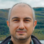
Dr Mete Pakdil
Mott MacDonald
Moata Geospatial Technical Lead

Evan Harwin
Mott MacDonald
Senior AI Engineer

Victoria King
Mott MacDonald
Principal Product Manager
Connecting AI to geospatial systems: EMMA, MCP and the future of digital delivery
How can geospatial move beyond specialists and become a day-to-day tool for everyone involved in project delivery? This session shows how AI-enabled, conversational workflows are helping Mott MacDonald bring geospatial insight to a whole new audience. Using EMMA, our AI assistant, and the Model Context Protocol (MCP), we demonstrate how natural-language interaction is making geospatial data easier to access, faster to adopt, and more valuable across the business – enabling more teams to use geospatial and a gentle learning curve for those new to the field.
Read More >>A flapping good model: Collaborative approaches to machine learning for biodiversity
11:00 - 11:30
Mott MacDonald showcase an innovative cross-disciplinary framework revolutionising habitat suitability modelling. Using advanced machine learning combined with ecological expertise, they've delivered a more robust, cost-effective survey and mitigation strategy for a major UK railway project.
With 1 million species threatened globally and 69% of UK species in decline, traditional approaches aren't enough. Learn how their integrated INLA and CircuitScape methodology identifies critical habitat corridors, reduces project risks and costs, and delivers measurable benefits for both the client and nature.
Speakers:

Matthew Lam
Mott MacDonald
Graduate Digital Consultant

Sam Smith
Mott MacDonald
Principal Ecologist
A flapping good model: Collaborative approaches to machine learning for biodiversity
Mott MacDonald showcase an innovative cross-disciplinary framework revolutionising habitat suitability modelling. Using advanced machine learning combined with ecological expertise, they've delivered a more robust, cost-effective survey and mitigation strategy for a major UK railway project. With 1 million species threatened globally and 69% of UK species in decline, traditional approaches aren't enough. Learn how their integrated INLA and CircuitScape methodology identifies critical habitat corridors, reduces project risks and costs, and delivers measurable benefits for both the client and nature.
Read More >>From smart data to smart decisions: How the geographic data service is applying AI to national research infrastructure
13:30 - 14:00
The Geographic Data Service (GeoDS) is a national research infrastructure turning smart data into actionable insights about places and populations across the UK.
In this session, we'll show how AI is transforming the way geographic data is discovered, processed, and delivered – from large language models powering semantic search, to deep learning pipelines extracting new insights from smart data. You'll gain practical insights into how we are deploying AI within an operational data service, learn how to balance automation with interpretability, and see how these approaches are already supporting thousands of researchers and policymakers working on issues from financial exclusion to environmental health.
Speakers:

Prof Alex Singleton
University of Liverpool
Professor of Geographic Information Science

Prof Paul Longley
University College London
Professor of Geographic Information Science
From smart data to smart decisions: How the geographic data service is applying AI to national research infrastructure
The Geographic Data Service (GeoDS) is a national research infrastructure turning smart data into actionable insights about places and populations across the UK. In this session, we'll show how AI is transforming the way geographic data is discovered, processed, and delivered – from large language models powering semantic search, to deep learning pipelines extracting new insights from smart data. You'll gain practical insights into how we are deploying AI within an operational data service, learn how to balance automation with interpretability, and see how these approaches are already supporting thousands of researchers and policymakers working on issues from financial exclusion to environmental health.
Read More >>
Beyond code: How AI is reshaping software engineering
AI is transforming software engineering – but not by replacing engineers. The real shift is what matters most: Data, systems thinking, and how we create value. This session explores how the Data Analytics Hierarchy of Needs, a practical framework inspired by Maslow's model, explains why AI and machine learning success depends on strong foundations – from data collection and storage to governance, analytics, and action. Without these layers, even advanced AI tools fail to deliver meaningful impact. It also examines how AI is reshaping roles across software engineering, including data engineers, data scientists, domain experts, and engineering leaders, as well as how AI coding agents are changing day-to-day expectations and team dynamics. As automation increases, success depends less on writing code and more on systems thinking, data readiness, and cross-functional alignment. Attendees will leave with a clear view of how AI creates value, how roles are evolving, and how to stay relevant in an AI-driven future.
Read More >>Making location intelligence AI-native: From spatial queries to natural language insights
10:00 - 10:30
Discover how AI is making location intelligence more accessible than ever. This session shows how natural language interfaces can unlock powerful spatial insights using modern data platforms, without requiring specialist GIS or SQL skills. Learn how organisations are combining AI with platforms like Databricks and Microsoft Fabric to turn business questions into trusted, scalable geospatial analytics, and see practical examples of AI in action that you can apply today.
Speakers:

Brynn Borton
Tekantis
CTO & Co-Founder
Making location intelligence AI-native: From spatial queries to natural language insights
Discover how AI is making location intelligence more accessible than ever. This session shows how natural language interfaces can unlock powerful spatial insights using modern data platforms, without requiring specialist GIS or SQL skills. Learn how organisations are combining AI with platforms like Databricks and Microsoft Fabric to turn business questions into trusted, scalable geospatial analytics, and see practical examples of AI in action that you can apply today.
Read More >>Speakers:
Brynn Borton
Tekantis
CTO & Co-Founder
Beyond the algorithm: Thriving as a geospatial professional in the age of AI
12:00 - 12:30
The geospatial industry is in the midst of a profound transformation, driven by the rapid evolution of Artificial Intelligence (AI). From automating tedious tasks to generating complex insights at an unprecedented scale, AI is reshaping how spatial data is generated, processed, and analysed. But what does the rise of AI mean for geospatial professionals?
Join Women+ in Geospatial for a thought-provoking panel discussion with leading experts as we explore the intersection of AI and the geospatial industry. We will delve into the opportunities and challenges this shift presents, and critically examine how AI is affecting job profiles, required skill sets, and the long-term career landscape.
Speakers:

Aaron Addison
World Geospatial Industry Council
Executive Director
Dr Julia Wagemann
Women+ in Geospatial / thriveGEO
Co-Founder & Director

Clare Seldon
Event Maps
Freelance Cartographer & Owner

Mariam Crichton
Mbodha / W+G
Strategic Partnerships Director

Marta Villalobos
Hackney Council
Senior Spatial Data Analyst
Beyond the algorithm: Thriving as a geospatial professional in the age of AI
The geospatial industry is in the midst of a profound transformation, driven by the rapid evolution of Artificial Intelligence (AI). From automating tedious tasks to generating complex insights at an unprecedented scale, AI is reshaping how spatial data is generated, processed, and analysed. But what does the rise of AI mean for geospatial professionals? Join Women+ in Geospatial for a thought-provoking panel discussion with leading experts as we explore the intersection of AI and the geospatial industry. We will delve into the opportunities and challenges this shift presents, and critically examine how AI is affecting job profiles, required skill sets, and the long-term career landscape.
Read More >>Speakers:
Aaron Addison
World Geospatial Industry Council
Executive Director
Dr Julia Wagemann
Women+ in Geospatial / thriveGEO
Co-Founder & Director
Clare Seldon
Event Maps
Freelance Cartographer & Owner
Mariam Crichton
Mbodha / W+G
Strategic Partnerships Director
Marta Villalobos
Hackney Council
Senior Spatial Data Analyst
GeoAgent: Ushering in the era of autonomous geospatial intelligence
11:30 - 12:00
Experience the future of geospatial intelligence with NV5 GeoAgent, an agentic AI platform that autonomously discovers and analyses data to deliver fast, explainable, mission-ready insights. Built to work across your existing systems, GeoAgent accelerates decisions and unlocks truly autonomous geospatial workflows.
Speakers:

Fergus Craig
NV5 Geospatial
Chair at AGI & UK Sales Manager

David Burridge
NV5 Geospatial
Director of Enterprise Solutions
GeoAgent: Ushering in the era of autonomous geospatial intelligence
Experience the future of geospatial intelligence with NV5 GeoAgent, an agentic AI platform that autonomously discovers and analyses data to deliver fast, explainable, mission-ready insights. Built to work across your existing systems, GeoAgent accelerates decisions and unlocks truly autonomous geospatial workflows.
Read More >>Natural language meets point cloud: Building an AI agent for spatial data
10:30 - 11:00
Spatial data is becoming conversational – and the GIS teams that understand this shift will have a significant advantage.
In this session, I'll demonstrate a working AI agent that queries and even modifies real point cloud and spatial datasets through natural language, handling the kind of complex, multi-step reasoning that off-the-shelf AI tools can't manage.
Beyond the demo, you'll walk away with a clear picture of what this architecture means for your own product or workflow, and how to approach it practically – no hype, no theory, just a working system and honest lessons from building it.
Speakers:

Alex Key
panoriq.ai
Founder
Natural language meets point cloud: Building an AI agent for spatial data
Spatial data is becoming conversational – and the GIS teams that understand this shift will have a significant advantage. In this session, I'll demonstrate a working AI agent that queries and even modifies real point cloud and spatial datasets through natural language, handling the kind of complex, multi-step reasoning that off-the-shelf AI tools can't manage. Beyond the demo, you'll walk away with a clear picture of what this architecture means for your own product or workflow, and how to approach it practically – no hype, no theory, just a working system and honest lessons from building it.
Read More >>Speakers:
Alex Key
panoriq.ai
Founder


What would it take to ACTUALLY save the world… using geospatial data?
From hunting and migration, to war and navigation – when civilisation has faced a problem it couldn't solve, someone turned geospatial data into a breakthrough that changed everything. Why should this time be any different? Aadam left Earth Sciences at Imperial College at 18, interviewed 500+ climate leaders to uncover the biggest challenges they faced, and built Apexion using GIS to solve it. Jake has spent 16 years at Getmapping bridging the gap between complex geospatial data and the real-world decisions it should be driving. Two different journeys. One big question. Come find out what history tells us about the next evolution of geospatial data – and what it would actually take for you to use it to save the world.
Read More >>Demo Stage

Advancements in LiDAR quality control: ASPRS density, positional validation/alignment, and datum transformations
As expectations for survey-grade lidar continue to rise, ensuring data accuracy and reliability is critical. In this session, discover the latest quality control tools in Global Mapper v27.0 designed to help you validate and refine your point cloud data with confidence. You’ll see how an ASPRS-recommended Voronoi method provides a more accurate way to measure point density and identify potential problem areas. We’ll also introduce new tools for quantifying horizontal and vertical offsets against control points, along with built-in adjustment capabilities to improve dataset accuracy. Finally, learn how industry-standard vertical and horizontal datum transformations can be applied seamlessly using the integrated GeoCalc® geodetic engine. Attend this session to gain practical techniques and tools for improving lidar quality, streamlining workflows, and meeting today’s highest geospatial standards.
Read More >>GeoAI Pitch Sessions
14:30 - 15:30
Created by Satellite Applications Catapult and Innovate UK in partnership with the Department for Environment, Food and Rural Affairs (Defra), the GeoAI Finalists bring innovators, public sector, researchers and industry together to build, validate, and showcase deployable EO+AI products.
Speakers:

Abigail Hoover
Orbiventure
CEO
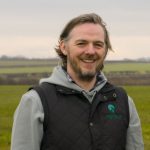
Dr Chris Knight
Agribot
CEO & Founder

Eleanor Thomson
Gentian
Lead Technologist
Luke Beer
Gentian
Senior Account Executive
Matthew Evans
EarthSavvy
CEO

Rhys Feeney
Ocean OS
Product Lead

Thomas Cromie
x10AI
Director & Co-Founder
GeoAI Pitch Sessions
Created by Satellite Applications Catapult and Innovate UK in partnership with the Department for Environment, Food and Rural Affairs (Defra), the GeoAI Finalists bring innovators, public sector, researchers and industry together to build, validate, and showcase deployable EO+AI products.
Read More >>
Atom: Direct satellite tasking in 60 seconds via web or API
Discover how ATOM is transforming satellite tasking and archive ordering with unprecedented speed and precision. In this session, we'll showcase how ATOM enables direct satellite tasking in just 60 seconds, provides real-time feasibility studies with 75+ inputs, and offers advanced project management tools to streamline operations. Join us for a live demo and see firsthand how ATOM simplifies complex workflows, ensuring seamless access to high-quality EO data. Whether you're a power user or new to satellite imagery, this session will equip you with the insights to maximise your geospatial capabilities.
Read More >>Mastering orthophotos: Best practices and the new ground orthophoto
11:00 - 11:30
Orthophotos are essential in surveying, but knowing which type to use, and when, can make a major difference in results. This session covers best practices for working with traditional, true, and custom plane orthophotos, and introduces the new ground orthophoto in 3Dsurvey. See how a bottom-up perspective reveals hidden ground features beneath vegetation and structures, and learn how to generate and export the right orthophoto for every project.
Speakers:

Matija Zupan
3Dsurvey
QA Manager
Mastering orthophotos: Best practices and the new ground orthophoto
Orthophotos are essential in surveying, but knowing which type to use, and when, can make a major difference in results. This session covers best practices for working with traditional, true, and custom plane orthophotos, and introduces the new ground orthophoto in 3Dsurvey. See how a bottom-up perspective reveals hidden ground features beneath vegetation and structures, and learn how to generate and export the right orthophoto for every project.
Read More >>Speakers:
Matija Zupan
3Dsurvey
QA Manager
From LiDAR QA to conversational GIS: How GIS-Point builds AI-native tools on open spatial stacks
15:30 - 16:00
GIS-Point builds AI-native tools on open spatial stacks. This session presents two live product cases from our IT Unit.
First: allgis.io, our production SaaS platform originally built for lidar quality control at scale – turnaround from weeks to days, 500 kilometres of LiDAR processed in four days at 97.2% accuracy.
Second: a natural language AI agent that talks to a PostGIS database – plain English in, geometry on a map and generated SQL out, auditable and domain-aware. Both running on PostGIS, FastAPI, and GeoServer.
Aimed at heads of technology, GIS managers, and CTOs evaluating how AI fits into existing spatial infrastructure without replacing it.
Speakers:

Ievgen Lavrishko
GIS-point.ltd
CEO
From LiDAR QA to conversational GIS: How GIS-Point builds AI-native tools on open spatial stacks
GIS-Point builds AI-native tools on open spatial stacks. This session presents two live product cases from our IT Unit. First: allgis.io, our production SaaS platform originally built for lidar quality control at scale – turnaround from weeks to days, 500 kilometres of LiDAR processed in four days at 97.2% accuracy. Second: a natural language AI agent that talks to a PostGIS database – plain English in, geometry on a map and generated SQL out, auditable and domain-aware. Both running on PostGIS, FastAPI, and GeoServer. Aimed at heads of technology, GIS managers, and CTOs evaluating how AI fits into existing spatial infrastructure without replacing it.
Read More >>Speakers:
Ievgen Lavrishko
GIS-point.ltd
CEO
Scan to floor plan: Indoor mapping made easy with Pointorama
Still relying on outdated floor plans or time-consuming scan to CAD/BIM workflows? Discover how indoor mapping can be simplified and significantly accelerated with Pointorama.
Read More >>
Launching the GEO100 2026
Join us for the launch of the GEO100 2026 awards programme. Find out why you should nominate yourself or a colleague and what the judges are looking for. Meet the team and network with winners from last year. We look forward to seeing you there!
Read More >>Utilising the RIEGL VZ-600i to leverage productivity without sacrificing accuracy – static and mobile scanning from one instrument
12:00 - 12:30
The versatile RIEGL VZ-600i terrestrial 3D laser scanner offers maximum efficiency for a wide range of applications. Using real-world projects, we demonstrate the high quality of the data, the user-friendly workflow in the field and during data processing, and the increased efficiency for the user. Discover new features such as data acquisition in kinematic mode from moving platforms. Find out how RIEGL LiDAR can also advance your business!
Speakers:

Dave Foster
RIEGL UK
Managing Director
Utilising the RIEGL VZ-600i to leverage productivity without sacrificing accuracy – static and mobile scanning from one instrument
The versatile RIEGL VZ-600i terrestrial 3D laser scanner offers maximum efficiency for a wide range of applications. Using real-world projects, we demonstrate the high quality of the data, the user-friendly workflow in the field and during data processing, and the increased efficiency for the user. Discover new features such as data acquisition in kinematic mode from moving platforms. Find out how RIEGL LiDAR can also advance your business!
Read More >>Speakers:
Dave Foster
RIEGL UK
Managing Director


Safest way: Turning public data into safer streets and smarter journeys
Can maps help people feel safer? Discover how Safest Way is using street lighting, crime, CCTV and environmental data to build safer walking routes for cities across the UK. A practical and inspiring session on geospatial innovation with real social impact.
Read More >>
Achieving centimetre accuracy anywhere
Learn how leading companies are leveraging cloud-based RTK to transform autonomous systems, surveying workflows, and precision applications with centimetre accuracy.
Read More >>Empowering the frontline: Geospatial intelligence for field technicians
10:30 - 11:00
Field teams working across asset-intensive industries need fast, reliable access to the information that keeps critical infrastructure running.
Join AMT-Sybex for a live demo of Geofield Cloud, a modern geospatial platform designed to equip field technicians with intuitive mapping tools, real-time asset visibility and access to vital network information wherever they are working. Drawing on decades of experience supporting utilities and infrastructure operators, this session will demonstrate how cloud-based geospatial solutions help organisations modernise field operations, improve situational awareness and empower technicians to work more safely and efficiently.
Discover how giving field teams the right geospatial intelligence at the right time helps organisations maintain essential infrastructure, support resilient networks and ultimately keep the lights on.
Speakers:

Stephen Meyer
AMT-Sybex
Sales Engineer
Empowering the frontline: Geospatial intelligence for field technicians
Field teams working across asset-intensive industries need fast, reliable access to the information that keeps critical infrastructure running. Join AMT-Sybex for a live demo of Geofield Cloud, a modern geospatial platform designed to equip field technicians with intuitive mapping tools, real-time asset visibility and access to vital network information wherever they are working. Drawing on decades of experience supporting utilities and infrastructure operators, this session will demonstrate how cloud-based geospatial solutions help organisations modernise field operations, improve situational awareness and empower technicians to work more safely and efficiently. Discover how giving field teams the right geospatial intelligence at the right time helps organisations maintain essential infrastructure, support resilient networks and ultimately keep the lights on.
Read More >>Speakers:
Stephen Meyer
AMT-Sybex
Sales Engineer

From data to decisions: A smarter way with Soarvo
Many GIS teams are working with increasingly complex, fragmented systems that make it difficult to fully leverage their geospatial data. This session explores a smarter, more unified approach. Discover how Soarvo enables organisations to bring together GIS, CAD, BIM, and reality capture data into a single 3D cloud environment — improving accessibility, reducing reliance on siloed tools, and enabling faster, more informed decision-making. Learn how a modern geospatial strategy can simplify workflows, increase flexibility, and unlock greater value from existing data.
Read More >>
How GNSS brings better quality to SLAM mapping
Come and see how SLAM can be corrected by GNSS
Read More >>Showcasing Korea’s next-generation geospatial innovators
11:00 - 12:00
Meet some of Korea's most promising geospatial startups in one session. From AI satellite analysis to drone-based disaster response and lunar mapping technology, K-GEO Festa brings together innovators redefining what's possible in the geospatial space. If you're looking for your next global partner or investment opportunity, this is the session to attend.
Speakers:

Kevin Yoo
StartRun
Manager, Global Business

Donguk Agos Lee
Base&PowerCity
CEO

Kim Hee-kwan
StellarVision
Team Leader

Ko Geon-woo
D.PRE
CEO

Lee Do-won
TelePIX
Manager

Lee In
Spaid
Director

Min Gyeong-won
AST Holdings
Senior Manager
Showcasing Korea’s next-generation geospatial innovators
Meet some of Korea's most promising geospatial startups in one session. From AI satellite analysis to drone-based disaster response and lunar mapping technology, K-GEO Festa brings together innovators redefining what's possible in the geospatial space. If you're looking for your next global partner or investment opportunity, this is the session to attend.
Read More >>Beyond automation: The rise of intelligent field robotics
14:30 - 15:00
See intelligent field robotics up close in this live demonstration session from NextGen Robotics & Innovation Ltd. From autonomous quadrupeds to AI-enabled operational platforms, discover how advanced robotics are being deployed across surveying, infrastructure inspection, industrial operations, and remote environments. Learn how robotics are improving safety, efficiency, and real-time decision-making in the field.
Speakers:

James Brown
NextGen Ri Ltd / Unitree Robotics
Managing Director

Nathan Wallace
NextGen Ri Ltd / Unitree Robotics
Head of Robotics
Beyond automation: The rise of intelligent field robotics
See intelligent field robotics up close in this live demonstration session from NextGen Robotics & Innovation Ltd. From autonomous quadrupeds to AI-enabled operational platforms, discover how advanced robotics are being deployed across surveying, infrastructure inspection, industrial operations, and remote environments. Learn how robotics are improving safety, efficiency, and real-time decision-making in the field.
Read More >>
Making the case for continuous monitoring
This session demonstrates how continuous displacement monitoring is redefining what's possible in geotechnical and structural monitoring, particularly in environments where GNSS and traditional methods fall short. Visitors will see the TotaLite A2.0 sensor live, with real-time sub-millimetre displacement data being captured and visualised on screen. The session walks through how continuous monitoring changes the risk profile of a project compared to periodic survey approaches and what that means in practice for decision-making, contractual obligations, and cost. Drawing on deployments in live tunnel environments and underground research facilities, we'll show what periodic monitoring misses, when it matters most, and how the economics stack up. Attendees will leave with a clear, evidence-based framework for evaluating whether continuous monitoring belongs in their next project specification. Enjoy a live product demonstration and open Q&A.
Read More >>Earth Observation & Insights Stage

Near-realtime Earth observation with Worldview Legion in 30 cm resolution
Looking for fastest solutions to monitor the Earth surface in resolution up to 30 cm? In this session we will explore EUSI's solutions to provide near real-time satellite access by its ground station and the WorldView Legion constellation. You will discover technological possibilities to access fresh imagery at multiple time points throughout the day with shortest delivery times. Whether you are an Earth observation specialist in public or private organisations you will leave this presentation with essential facts at the forefront of technology.
Read More >>Monitoring Britain’s rail network from Space: How satellite technology is transforming nationwide asset management
10:30 - 11:00
This presentation offers a timely, real-world case study of how satellite data combined with geospatial technology and subject matter expertise is solving a critical infrastructure challenge at national scale. With rail networks globally facing increasing pressure from climate change, ageing assets, and budget constraints, the lessons from Network Rail's pioneering adoption of satellite technology are highly relevant to GEO Business attendees across multiple sectors.
The talk aligns directly with GEO Business themes of earth observation, remote sensing, and using location data to solve real-world problems, delivered by a CEO with hands-on experience of deploying these solutions at scale.
Speakers:

Dr Matthew Bray
SatSense
CEO
Monitoring Britain’s rail network from Space: How satellite technology is transforming nationwide asset management
This presentation offers a timely, real-world case study of how satellite data combined with geospatial technology and subject matter expertise is solving a critical infrastructure challenge at national scale. With rail networks globally facing increasing pressure from climate change, ageing assets, and budget constraints, the lessons from Network Rail's pioneering adoption of satellite technology are highly relevant to GEO Business attendees across multiple sectors. The talk aligns directly with GEO Business themes of earth observation, remote sensing, and using location data to solve real-world problems, delivered by a CEO with hands-on experience of deploying these solutions at scale.
Read More >>Speakers:
Dr Matthew Bray
SatSense
CEO
Mapping change from space: How Earth observation, AI and geospatial analytics could transform transport & infrastructure management
Discover the future of infrastructure monitoring from space. Join Tracsis Geo Intelligence at GEO Business for a compelling session on how Earth observation (EO), AI, and advanced geospatial analytics could transform the way transport and infrastructure networks are managed. As land-use change, climate pressures, and operational demands intensify, traditional survey methods can no longer keep pace. This session reveals how satellite-derived intelligence – integrated directly into GIS and asset management workflows – could enable organisations to monitor change continuously, detect risks earlier, and make more confident, data-driven decisions. You'll see how AI accelerates insight generation across vast linear networks, how EO fits seamlessly into existing geospatial ecosystems, and how this technology is ready to deliver measurable value to UK transport and infrastructure programmes. Featuring real examples, practical demonstrations, and a live look at EO-powered change detection, this talk is ideal for geospatial leaders and GIS professionals seeking smarter, scalable ways to manage complex assets. Unlock the power of space-based intelligence to strengthen resilience, reduce costs, and future-proof your infrastructure strategy.
Read More >>Celebrate excellence with the Association for Geographic Information 2026 Awards
The Association for Geographic Information 2026 Awards celebrate excellence in geospatial. With submissions and nominations from across the sector, the awards showcase innovation, achievements, and best practice, and are open to any individual, group or organisation that can demonstrate and communicate success through the use of geographic data, knowledge or technology. Winners will be announced and awards presented at GEO Business, the geospatial event, which takes place at ExCeL London, on the 3–4 June 2026. Join the AGI, its award winners, and industry partners, to celebrate the achievements and developments that ensure that geospatial continues to underpin a safe, sustainable, and successful future.
Read More >>Orbit to impact: Scaling AI-driven satellite intelligence
12:00 - 12:30
Satellite-based geospatial data, combined with advances in artificial intelligence, is transforming how organisations understand risk, build resilience, and unlock new commercial opportunities across the economy. From climate and nature recovery to finance, agriculture, and utilities, these technologies are moving rapidly from experimental pilots to operational, decision-grade services.
This Tech Showcase and Panel Discussion brings together 3 leading organisations operating at the intersection of satellite geospatial solutions and AI. Through real-world use cases and expert discussion, the session will explore how these technologies are being deployed today, the value they are delivering, and the journey ahead to scale impact across multiple sectors.
Speakers:

Alexandra Barker
Telespazio UK
Head of Sales Operations & Institutional Business Growth

Donna Lyndsay
Space4Climate
Climate Services Development Manager

James Brennan
Climate X
Director of Science

Kirthi K
The Netzero Protocol
CEO
Orbit to impact: Scaling AI-driven satellite intelligence
Satellite-based geospatial data, combined with advances in artificial intelligence, is transforming how organisations understand risk, build resilience, and unlock new commercial opportunities across the economy. From climate and nature recovery to finance, agriculture, and utilities, these technologies are moving rapidly from experimental pilots to operational, decision-grade services. This Tech Showcase and Panel Discussion brings together 3 leading organisations operating at the intersection of satellite geospatial solutions and AI. Through real-world use cases and expert discussion, the session will explore how these technologies are being deployed today, the value they are delivering, and the journey ahead to scale impact across multiple sectors.
Read More >>Future talent: Why different people will be tomorrow’s leaders
12:30 - 13:00
The geospatial industry is changing fast. AI is reshaping entry-level roles, and the next generation of talent is questioning whether traditional employment models work for them. Many are choosing self-employment or building their own ventures. The leadership pipeline looks different than it did five years ago.
Join this panel discussion chaired by Mo Kanjilal, Founder & Director at Edge of Difference, a leading diversity, equity and inclusion company. Mo is a TEDx speaker, author and Founder of Edge of Difference, this panel session asks the question that matters: who will lead the geospatial industry next, and are organisations ready for them?
We will examine what genuine diversity of gender, race, neurodiversity, socio-economic background and age means for leadership in this sector, and leave you with practical ideas you can act on now.
Speakers:

Simon Navin
Ordnance Survey
Head of Geospatial Services

Mo Kanjilal
Edge of Difference
Founder & Director

Rachel Tidmarsh
Bluesky
CEO

Sarah Lewin
Esri UK
Head of Products
Future talent: Why different people will be tomorrow’s leaders
The geospatial industry is changing fast. AI is reshaping entry-level roles, and the next generation of talent is questioning whether traditional employment models work for them. Many are choosing self-employment or building their own ventures. The leadership pipeline looks different than it did five years ago. Join this panel discussion chaired by Mo Kanjilal, Founder & Director at Edge of Difference, a leading diversity, equity and inclusion company. Mo is a TEDx speaker, author and Founder of Edge of Difference, this panel session asks the question that matters: who will lead the geospatial industry next, and are organisations ready for them? We will examine what genuine diversity of gender, race, neurodiversity, socio-economic background and age means for leadership in this sector, and leave you with practical ideas you can act on now.
Read More >>
From satellite to nature strategy: Turning Earth observation data into LNRS measures mapping
Local Nature Recovery Strategies (LNRS) outline where nature should be restored, enhanced, and better connected, but translating that ambition into spatially explicit, defensible measures requires robust geospatial analysis and Earth observation (EO) data. This session demonstrates how geospatial analysis, connectivity modelling, and EO-derived data were combined to deliver county-scale LNRS measures mapping in practice for Wiltshire County Council. Using advanced geospatial analysis, habitat knowledge, and least-cost modelling, we show how priority intervention areas can be systematically identified to strengthen ecological networks and improve functional connectivity. The session focuses on methodological transparency, operational delivery, and scalability, offering a replicable framework for embedding EO-driven LNRS into spatial planning and long-term environmental strategy. Designed for professionals in local government, environmental consultancy, ecology, planning, and geospatial technology, this session provides a technically grounded example of how LNRS can be translated into measurable, data-fuelled spatial strategy.
Read More >>Community driven drone mapping
15:00 - 15:30
In low-income and disaster-prone areas, access to near real-time satellite datasets is severely limited. High-resolution satellite imagery, when available, is also often expensive and out-of-date.
In this presentation, followed by an interactive discussion with the audience, you will hear how Humanitarian OpenStreetMap Team (HOT) is addressing this problem through its end-to-end open mapping solution and specifically the development of the Drone Tasking Manager (DroneTM) – an open source tool for anyone with access to low-cost, accessible drones to collaboratively collect high-quality aerial imagery and data on the scale of thousands of square kilometres.
You will learn how it all works in practice and leave inspired by hearing the real-life stories where the Drone Tasking Manager is already making an impact – from Mexico to Bali and Sierra Leone. Last but not least, you will learn how YOU and your organisation can get involved!
At HOT, we believe that drones belonging to and operated by communities are more effective because they are in place and can respond immediately, responsibly, and take into account the needs of the community as they see them, keeping both the technology and decision-making power in local hands.
Speakers:

Rebecca Firth
Humanitarian OpenStreetMap Team (HOT)
Executive Director

Petya Kangalova
Humanitarian OpenStreetMap Team (HOT)
Senior Tech Partnership & Engagement Lead
Community driven drone mapping
In low-income and disaster-prone areas, access to near real-time satellite datasets is severely limited. High-resolution satellite imagery, when available, is also often expensive and out-of-date. In this presentation, followed by an interactive discussion with the audience, you will hear how Humanitarian OpenStreetMap Team (HOT) is addressing this problem through its end-to-end open mapping solution and specifically the development of the Drone Tasking Manager (DroneTM) – an open source tool for anyone with access to low-cost, accessible drones to collaboratively collect high-quality aerial imagery and data on the scale of thousands of square kilometres. You will learn how it all works in practice and leave inspired by hearing the real-life stories where the Drone Tasking Manager is already making an impact – from Mexico to Bali and Sierra Leone. Last but not least, you will learn how YOU and your organisation can get involved! At HOT, we believe that drones belonging to and operated by communities are more effective because they are in place and can respond immediately, responsibly, and take into account the needs of the community as they see them, keeping both the technology and decision-making power in local hands.
Read More >>
Combating catastrophes: Helping insurers navigate the most challenging circumstances with geospatial technology and military intelligence expertise
Hear how experience in British Military intelligence operations inspired a game-changing application of geospatial technology for the insurance industry, to enhance their response to global catastrophic events through the unique combination of data, technology and human-led expert analysis.
Read More >>
Just get it working! Time to get space data into operational systems
There's so much potential in using data from space but there's a long way to go before we're getting it into operational and decision-making systems! But interoperability is not just about technical infrastructure and data working together – it's also whole systems and people. In this session you can learn from some current programmes addressing getting people, space data and systems working together and how you can make a start with "just getting it working" too.
Read More >>
SeaScope: From space to spill – transforming offshore pollution monitoring
Monitoring the temporal and spatial variability of offshore oil pollution is crucial for environmental protection and regulatory compliance. Whilst one-off vessel related events can be highly damaging, unnoticed releases related to oil and gas infrastructure have the potential to cause long-lasting environmental damage. Satellite Earth observation (EO) delivers high-cadence, global coverage of the oceans, and when combined with machine learning (ML) and high-performance computing (HPC), it allows oil slicks to be monitored daily on a global scale. This session introduces SeaScope, a system that uses Viridien's HPC infrastructure to process petabyte-scale EO archives and daily data streams in near real time. Trained on over 50 years of satellite data and developed with support from industry and the European Space Agency, SeaScope establishes baselines of "normal working conditions" and characterises slick morphology, distribution and variability distinguishing anomalous oil on the surface. Site-specific thresholds then enable robust anomaly detection and early warning of anomalous events. We will present case studies from regions including the North Sea, the Malacca Strait and the east coast of the United States, demonstrating how SeaScope provides a step-change in oil pollution monitoring. Oil and gas monitoring is just the start though: the same framework is now being applied to wider maritime risks, including potentially polluting wrecks and other emerging environmental challenges.
Read More >>Closing the methane gap: Satellite intelligence for ESG risk mitigation
11:30 - 12:00
The global energy sector currently operates with a critical blind spot: fugitive, unreported methane emissions. In this session, Nara Space CEO Jae-Pil Park introduces the NarSha satellite constellation, a first-of-its-kind solution designed to close this data gap. Capable of detecting facility-level leaks down to 100 kg/hr of CH₄, NarSha’s hyperspectral imaging establishes a new standard for asset-level monitoring. Highlighting an upcoming deployment in South Korea’s Gyeonggi Province, this case study illustrates how targeted regional space initiatives provide a new blueprint to complement national reporting frameworks, enabling both energy leaders and governments to build robust, data-driven emission strategies.
Speakers:

Jae-Pil Park
Nara Space Technology
CEO
Closing the methane gap: Satellite intelligence for ESG risk mitigation
The global energy sector currently operates with a critical blind spot: fugitive, unreported methane emissions. In this session, Nara Space CEO Jae-Pil Park introduces the NarSha satellite constellation, a first-of-its-kind solution designed to close this data gap. Capable of detecting facility-level leaks down to 100 kg/hr of CH₄, NarSha’s hyperspectral imaging establishes a new standard for asset-level monitoring. Highlighting an upcoming deployment in South Korea’s Gyeonggi Province, this case study illustrates how targeted regional space initiatives provide a new blueprint to complement national reporting frameworks, enabling both energy leaders and governments to build robust, data-driven emission strategies.
Read More >>Speakers:
Jae-Pil Park
Nara Space Technology
CEO

Global Tailings Monitoring Service: An integrated EO solution for TSFs
Viridien’s Global Tailings Monitoring Service (GTMS), developed with ESA Space Solutions, delivers automated, high-frequency remote monitoring of tailings storage facilities using integrated Earth observation and environmental data on a single online platform. Powered by high-performance computing, GTMS scales from single sites to global portfolios to rapidly detect early warning precursors and provide actionable safety intelligence.
Read More >>
DTM at the push of a button: Automated, image-based terrain modeling with ultraMap for scalable mapping and Digital Twins
Producing accurate DTMs from imagery no longer has to be complex or manual. This session reveals how the new, fully automated photogrammetric terrain modelling approach delivers consistent, production-ready DTMs at the push of a button. Learn how AI-driven image segmentation and intelligent surface refinement are transforming large-scale mapping, reducing costs, and enabling more reliable Digital Twins.
Read More >>
The Royal Geographical Society Disaster Risk Management Professional Practice Group
Fostering a community of disaster risk management professionals, the Royal Geographical Society Disaster Risk Management Professional Practice Group (DRM PPG) brings together risk-focused professionals from across disaster risk reduction, re/insurance and the humanitarian, governmental and academic sectors, to promote best practice and shared geographical knowledge and skills.
Read More >>
Bare earth, bold targets – hyperspectral exploration across the globe
The EMIT Bare Earth product is a revolutionary advancement in mineral mapping. By leveraging Viridien's High-Performance Computing solutions, we continue to generate high-quality mosaics of hyperspectral satellite data that minimise cloud cover, hillshade, and vegetation worldwide. This gives you the best possible view of the bare earth at an unmatched spectral resolution, enabling detection of individual mineral species. In this presentation, we'll show you how to use the data-driven Linear Spectral Unmixing approach to search for key minerals in your area of interest (AOI), or apply the knowledge-driven Minimum Wavelength Maps to identify anomalies and outliers that may warrant further investigation. Attend this session to learn how tailored spectral processing can comprehensively identify and prioritise your exploration targets.
Read More >>Environmental due diligence and corporate reporting
11:00 - 11:30
The session will explore the related challenges across industry and what has to be done to ensure that we are able to comply with nature based legislation now and in the future. We will then share the toolkit, workflows and infrastructure Arup has built to ensure that Nature related data is easy to access for all projects. Better Data = Better Nature
Speakers:

Damien McCloud
Arup
Director
Environmental due diligence and corporate reporting
The session will explore the related challenges across industry and what has to be done to ensure that we are able to comply with nature based legislation now and in the future. We will then share the toolkit, workflows and infrastructure Arup has built to ensure that Nature related data is easy to access for all projects. Better Data = Better Nature
Read More >>Speakers:
Damien McCloud
Arup
Director

Integrating InSAR into engineering geological practice: Insights from urban excavation and slope failure
Satellite Interferometric Synthetic Aperture Radar (InSAR) is increasingly being integrated into the engineering geology workflow for infrastructure projects, providing spatially continuous ground deformation measurements across wide areas. This presentation demonstrates the power of InSAR through two contrasting Italian case studies. The first examines the January 2026 Niscemi landslide, where long-term satellite archives reveal regional deformation patterns and short-term datasets capture the acceleration preceding failure. By analysing all spatial scales, the temporal evolution of instability is reconstructed. InSAR uniquely delivers retrospective, quantitative measurements of historical ground behaviour, providing critical insight into legacy deformation patterns. The second case study covers excavations of the Milan Metro Line 4 (2019–2021), where InSAR characterises pre-construction conditions and detects millimetre-scale subsidence during tunnelling beneath a dense urban centre. The study illustrates the advantages of consistent, wide-area satellite monitoring for measuring and contextualising ground movements across complex urban settings. Together, these examples demonstrate how InSAR complements investigation and modelling, enabling evidence-based decision-making in challenging engineering settings.
Read More >>Zero-hallucination pipelines: AI-powered SpaceOps grounded in live environments
12:00 - 12:30
The biggest challenge in Earth Observation (EO) is no longer data collection, but data efficiency: processing and scaling meaningful information – with true economic viability. Adopting useful AI tools is crucial for the space sector to facilitate this transition. However, traditional Large Language Models (LLMs) often risk errors by "hallucinating" field names for geospatial data. This session will introduce and demonstrate how the Model Context Protocol (MCP) supports reliable pipeline automation and AI tooling for near real-time intelligence and scalable monetisation.
Speakers:

Stefan Amberger
Tilebox
Co-Founder
Zero-hallucination pipelines: AI-powered SpaceOps grounded in live environments
The biggest challenge in Earth Observation (EO) is no longer data collection, but data efficiency: processing and scaling meaningful information – with true economic viability. Adopting useful AI tools is crucial for the space sector to facilitate this transition. However, traditional Large Language Models (LLMs) often risk errors by "hallucinating" field names for geospatial data. This session will introduce and demonstrate how the Model Context Protocol (MCP) supports reliable pipeline automation and AI tooling for near real-time intelligence and scalable monetisation.
Read More >>Speakers:
Stefan Amberger
Tilebox
Co-Founder
GIS & Location Intelligence Stage

How can geospatial be used for decision making?
Patients should have access to the right treatment, at the right place at the right time; patient choice is a powerful driver for improving quality and efficiency of services. The Urgent and Emergency Care mapping solution was developed to eliminate the barriers in accessing services that patients face. It equips commissioners with the insight they need to understand the current urgent care system. At its core, this tool is about improving lives. It ensures patient choice drives better quality and more efficient care, while making sure communities aren't overlooked. By identifying areas with limited access, particularly vulnerable populations, it guides decisions that reduce inequalities and improve health outcomes. It does not just show where services exist. It reveals where they are needed most, and why. The tool is built with sustainability and social value in mind. It incorporates travel analysis to support low carbon planning and helps futureproof urgent care provision. Through bivariate mapping, it highlights communities facing multiple layers of disadvantage, combining data on deprivation and population density to pinpoint where transformation is most urgent. In a system under pressure, where targets like the 18-minute response time for Category 2 ambulance calls and the four-hour A&E waiting times have consistently been missed, the mapping solution offers a practical way forward. It models the impact of upgrading or closing sites, factoring in age, health status, and deprivation. It also allows commissioners to explore different journey lengths and urgency levels, enabling more strategic and targeted interventions. This is not just a technical tool. It is a strategic asset that supports commissioners in making informed, evidence-based decisions. It helps relieve pressure on emergency departments and ensures service transformation aligns with clinical priorities and the needs of the communities they serve.
Read More >>
Automating asset clash detection: A GIS‑driven workflow
Utility company assets such as pipelines or sewers are often required to be diverted or altered where construction of new major infrastructure projects like highways or railways are planned to be built in close proximity. Explore a fully automated geoprocessing framework designed to detect, classify and assess asset conflicts within Nationally Significant Infrastructure Project boundaries. This session demonstrates how ArcGIS Pro ModelBuilder and custom Python geoprocessing tools can replace manual time-intensive interrogation of spatial data, significantly boosting efficiency and improving data quality. Attendees will also see ClashScape, an Experience Builder interface for visualising clashes and learn how smart forms are used to structure detailed assessment of impacts and potential mitigations by engineers.
Read More >>Future geo talent: Apprenticeship experiences and shaping the next generation
12:30 - 13:00
Geospatial apprenticeships are playing an increasingly important role in building the UK’s future geo workforce, but what is the experience really like for those entering the profession this way?
This panel brings together geospatial apprentices to share honest reflections on their journeys into the sector. From successes and opportunities to challenges and lessons learned, the discussion will explore how apprenticeships are shaping early-career talent and how the industry can evolve to better support the next generation.
Aligned with the AGI Foresight Report’s Great Skills Shift, this session will provide valuable insights into how apprenticeships can strengthen skills pipelines, improve accessibility into geospatial careers, and support organisations navigating rapid technological and workforce change.
Speakers:

Dr Patrick Rickles
Association for Geographic Information
Director for Education & Skills

Clara Brand
Jacobs
Apprentice Land Surveyor

Tijo Joyson
Jacobs
Geospatial Apprentice
Future geo talent: Apprenticeship experiences and shaping the next generation
Geospatial apprenticeships are playing an increasingly important role in building the UK’s future geo workforce, but what is the experience really like for those entering the profession this way? This panel brings together geospatial apprentices to share honest reflections on their journeys into the sector. From successes and opportunities to challenges and lessons learned, the discussion will explore how apprenticeships are shaping early-career talent and how the industry can evolve to better support the next generation. Aligned with the AGI Foresight Report’s Great Skills Shift, this session will provide valuable insights into how apprenticeships can strengthen skills pipelines, improve accessibility into geospatial careers, and support organisations navigating rapid technological and workforce change.
Read More >>Digital asset management: How to manage materials excavated during the construction of HS2
15:00 - 15:30
The construction of the HS2 rail network has resulted in what the Council for British Archaeology describes as an "unprecedented amount and array of items," found during excavation. In this session, attendees will learn how Arup & Headland Archaeology have collaborated to design a bespoke digital asset management system to keep track of boxes of material as they are transported around the UK.
Not only will attendees get a real-world view into the cataloguing of archaeological material on HS2 (as seen on BBC news recently!), they will also be able to learn how geospatial and digital technologies can be used to create a robust digital asset management system. The interoperability between FME, ArcGIS Survey123 and Microsoft Power BI will be demonstrated, showing how these applications alongside a well-designed data pipeline can unlock value for the client.
Speakers:

Ashley Barnes
Arup
Senior GIS Consultant
Digital asset management: How to manage materials excavated during the construction of HS2
The construction of the HS2 rail network has resulted in what the Council for British Archaeology describes as an "unprecedented amount and array of items," found during excavation. In this session, attendees will learn how Arup & Headland Archaeology have collaborated to design a bespoke digital asset management system to keep track of boxes of material as they are transported around the UK. Not only will attendees get a real-world view into the cataloguing of archaeological material on HS2 (as seen on BBC news recently!), they will also be able to learn how geospatial and digital technologies can be used to create a robust digital asset management system. The interoperability between FME, ArcGIS Survey123 and Microsoft Power BI will be demonstrated, showing how these applications alongside a well-designed data pipeline can unlock value for the client.
Read More >>Speakers:
Ashley Barnes
Arup
Senior GIS Consultant

From hype to value: The state of UK geospatial intelligence adoption
Geospatial technology is now a critical enabler for confident, data-driven decision-making across the UK economy, but adoption and maturity still vary significantly between sectors. In this session, Josh Rains, Managing Director of Landmark Geodata, reveals the findings of Landmark's new cross-sector research into the state of geospatial data and location intelligence adoption, across the UK economy. The session will unpack the key drivers accelerating geospatial uptake, from rising data literacy to improved tools and analytical capabilities, while also addressing the persistent challenges organisations face: skills shortages, constrained budgets, fragmented or hard-to-access data, and the weight of legacy systems. Attendees will gain a clear view of how policy, regulation, and industry-wide initiatives are shaping adoption pathways and influencing future investment. Crucially, the session will separate hype from genuine value. The research explores how UK organisations are defining ROI, prioritising investment areas that deliver measurable impact, and embedding location intelligence into operational workflows. Finally, Josh will look ahead to the emerging themes reshaping the geospatial landscape – from AI and automation to new data assets and evolving partnership ecosystems. All attendees will receive exclusive early access to download the full research report before its public release.
Read More >>
National Trails Nature Hub: Accelerating nature recovery through the power of GIS
A National Trail often conjures images of a path winding through beautiful countryside. But what if this landscape was silent and bare? No wildflowers to smell, butterflies to see or skylarks calling across the moor? With biodiversity loss, climate pressures and shrinking resources, this future is a real risk for the UK's 8,500 km network of 20 National Trails. But what if those same trails became thriving ecological corridors – restoring nature at scale while improving access for people? Supported by the Esri UK Not-for-Profit Programme, the National Trails Nature Hub places location intelligence at the heart of this vision. Evolving from a static PDF data report created in ArcGIS Pro into an interactive tool built with ArcGIS Experience Builder, the Hub empowers non-GIS specialists – from National Trails UK staff to on-the-ground National Trail Officers – to turn insight into action. It has already transformed ways of working, saving 10% of staff capacity in our small national team. In this fast-paced 25-minute workshop, delivered as a snakes-and-ladders style board game, you'll step into the shoes of a National Trail Officer – testing how data-driven insight can unlock funding, partnerships and tangible nature recovery outcomes.
Read More >>From readiness to reality: A live audit of your geospatial adoption maturity
Organisations across the UK are accelerating their use of geospatial data to improve decision-making, manage risk, support planning and infrastructure, and unlock operational efficiencies. Yet Landmark Geo's latest market research, launching here at GeoBusiness, consistently shows that adoption and maturity vary dramatically across sectors, with many teams unsure where they sit on the curve, or what steps will move them forward. This session offers a chance to step back and reflect. From readiness to reality is a highly interactive, diagnostic-led workshop designed to help you understand your current level of geospatial maturity, benchmark yourself against industry adoption stages, and leave with a clear, actionable roadmap aligned to their organisation's needs. The heart of the workshop is a live, onscreen readiness audit, which gives you the chance to anonymously score yourself across various critical capabilities and readiness factors and compare this to others in the room to build a real-time picture of geospatial adoption maturity. After mapping your score against our adoption maturity stages we'll provide recommendations and next steps tailored to each maturity stage, giving you clear and actionable recommendations to improve your geospatial adoption and turn readiness into reality.
Read More >>The use of AI in urban Digital Twins – real examples
15:30 - 16:00
The rapid evolution of urban environments necessitates advanced data-driven solutions to address complex citizen demands and sustainability goals. We'll explore the integration of artificial intelligence (AI) and geospatial technologies within the framework of urban Digital Twins (UDT). By creating dynamic digital replicas of physical cities, these systems transition beyond static 3D models to provide real-time monitoring and predictive simulations.
Drawing on real-world use cases – such as the implementation of UDTs in the City of Genoa for infrastructure management and in Klagenfurt for climate goal tracking – we examine how AI enhances decision-making in critical sectors including transportation, public safety, and environmental management. Key applications discussed include the use of AI-powered remote sensing for situational awareness and computational fluid dynamics (CFD) to mitigate heat islands and flood risks. The findings demonstrate that by automating data handling and breaking departmental silos, urban Digital Twins empower governments to optimise resources, increase transparency, and build resilient, smart communities that effectively respond to the evolving needs of their citizens.
Speakers:

Richard Goodman
Octave
Consultant
The use of AI in urban Digital Twins – real examples
The rapid evolution of urban environments necessitates advanced data-driven solutions to address complex citizen demands and sustainability goals. We'll explore the integration of artificial intelligence (AI) and geospatial technologies within the framework of urban Digital Twins (UDT). By creating dynamic digital replicas of physical cities, these systems transition beyond static 3D models to provide real-time monitoring and predictive simulations. Drawing on real-world use cases – such as the implementation of UDTs in the City of Genoa for infrastructure management and in Klagenfurt for climate goal tracking – we examine how AI enhances decision-making in critical sectors including transportation, public safety, and environmental management. Key applications discussed include the use of AI-powered remote sensing for situational awareness and computational fluid dynamics (CFD) to mitigate heat islands and flood risks. The findings demonstrate that by automating data handling and breaking departmental silos, urban Digital Twins empower governments to optimise resources, increase transparency, and build resilient, smart communities that effectively respond to the evolving needs of their citizens.
Read More >>Speakers:
Richard Goodman
Octave
Consultant

Humanitarian OpenStreetMap Team – missing maps Mapathon
Every year, disasters around the world claim nearly 100,000 lives and affect or displace more than 200 million people. Many of the places where these crises occur are literally missing from maps, leaving first responders without the information they need to make fast, effective decisions. Missing Maps is an open, collaborative initiative working to change that. By contributing to humanitarian mapping, you help ensure that organisations on the ground have accurate geographic data to support vulnerable communities. The Humanitarian OpenStreetMap Team (HOT) supports community mapping projects globally and empowers local communities to create their own maps for socio-economic development and disaster preparedness. Join us for this mapathon, using MapSwipe and contribute to ongoing Missing Maps projects. No prior experience is required – just curiosity, willingness to learn, the desire to make a real impact and MapSwipe free app on your mobile. https://mapswipe.org/en/index.html
Read More >>
The Great British Interest Map: Geospatial insights into regional behaviours
Dive into the intersection of geospatial data and audience behaviour, where we will be mapping out the unique interests and digital habits of communities across the UK.
Read More >>More than maps
More than Maps showcases how Ordnance Survey is helping people build real‑world geospatial skills, not just produce maps. This session introduces OS’s More than Maps learning platform and demonstrates how practical guidance, best practice, and applied examples can help users move from data to confident decision‑making. Whether you’re new to OS data or looking to deepen your expertise, discover how More than Maps helps turn location data into insight, impact, and value.
Read More >>
From static maps to strategic platforms: Rebuilding local government GIS for the next decade
GIS is evolving from mapping tool to strategic infrastructure. Discover how configurable web GIS platforms are reshaping cadastre management, urban planning and operational services, and how your organisation can move from fragmented maps to a unified decision engine.
Read More >>
Harnessing the power of geospatial data for increasing regional outreach with data driven digital PR
Data-driven digital PR is one of the most effective ways to earn high-quality links and brand mentions to support SEO performance and visibility in AI-driven search results. In this talk, I’ll focus on one of the most underused and overlooked data sources in Digital PR: geospatial data.
Read More >>Cadastre, zoning and planning in one ecosystem: Ending the fragmentation problem
Still juggling separate systems for cadastre, zoning and planning? Learn how an integrated GIS ecosystem can streamline workflows, improve compliance and empower both planners and citizens – all within one platform.
Read More >>
How to submit a FRIDAS‑compliant BNG package
Learn exactly what a FRIDAS®-compliant BNG submission looks like. This session provides a clear, practical template covering folder structure, naming conventions, metadata requirements, and essential attribute fields. As FRIDAS evolves toward a consistent sector standard, this session will help teams prepare reliable, audit-ready submissions that meet emerging expectations across the BNG landscape.
Read More >>Ecosystem service priority mapping with Open-Source GIS & Python
Environmental decision-making is becoming more complex and more urgent. This session introduces ecosystem service priority mapping: a practical, data-driven approach to identifying where land-use interventions will deliver the greatest ecological benefit. Using our recent project with the Joint Nature Conservation Committee as a case study, we'll show how automated, open-source workflows can unlock consistent, transparent, and reproducible prioritisation at scale. You'll see how Ramboll combined environmental expertise with Python-based automation to create national-scale priority maps for coastal water quality, river erosion, coastal erosion, and flow variability. We'll explore how automation eliminates manual bottlenecks, improves quality control, accelerates iteration, and empowers clients to continue evolving their analyses independently. This session is ideal for geospatial practitioners, environmental planners, data scientists, and anyone looking to streamline spatial decision support workflows. Attendees will gain clear, actionable insights into implementing reproducible analytics using open-source tools and learn how these methods can be applied to natural capital, biodiversity, and broader environmental planning.
Read More >>Why addresses matter: Powering better health decisions
11:30 - 12:00
Addresses are everywhere in healthcare – yet few people realise how critical they are to service design, developing neighbour strategies and tackling health inequalities. This session reveals how address data quietly powers some of the NHS's most important digital services, and what happens when it goes wrong.
Join James Lockyer, Lead Data Engineer at NHS England, and Dominic Cuthbert as they unpack how patient addresses are captured through the NHS Spine and Personal Demographic Service, and how that data is used far beyond sending letters. Through real-world NHS examples, you'll see how accurate addressing supports care home identification, vaccine monitoring, GP list management, neighbourhood health services, and population health insight.
The session also looks ahead to the NHS's ambitions for a single, standardised Address Index built on national standards and UPRNs – and why this is a foundational step for joined-up care and better outcomes. If you work in data, digital, analytics, or service design, this talk will change how you think about one of the most underestimated data assets in healthcare.
Speakers:

Dominic Cuthbert
Ordnance Survey
Health Sector Lead

James Lockyer
NHS England
Senior Data Engineer
Why addresses matter: Powering better health decisions
Addresses are everywhere in healthcare – yet few people realise how critical they are to service design, developing neighbour strategies and tackling health inequalities. This session reveals how address data quietly powers some of the NHS's most important digital services, and what happens when it goes wrong. Join James Lockyer, Lead Data Engineer at NHS England, and Dominic Cuthbert as they unpack how patient addresses are captured through the NHS Spine and Personal Demographic Service, and how that data is used far beyond sending letters. Through real-world NHS examples, you'll see how accurate addressing supports care home identification, vaccine monitoring, GP list management, neighbourhood health services, and population health insight. The session also looks ahead to the NHS's ambitions for a single, standardised Address Index built on national standards and UPRNs – and why this is a foundational step for joined-up care and better outcomes. If you work in data, digital, analytics, or service design, this talk will change how you think about one of the most underestimated data assets in healthcare.
Read More >>
Modern big data analytics: An introduction to Vector and Raster workflows for cloud-native web-GIS
This talk presents modern cloud-native workflows that use optimised formats and serverless data access to bring advanced analytics and fast performance to the browser. Engineering, environmental, and transport planning organisations now depend on ever-growing geospatial datasets, from satellite time series to model simulations and long-term sensor records. However, many still rely on traditional web-GIS systems that push all computation through a single heavy-duty server. Supported by real examples from the fields of nature-based solutions, flood risk assessment, and noise monitoring, Ollie will show how WebAssembly lets the browser run SQL queries, decode rasters and apply transformations directly against cloud-hosted data, enabling fast, interactive exploration without a GIS server. He will then demonstrate how scalable compute efficiently handles heavier analysis using cloud-native vector and raster formats. Finally, we will explore how the SpatioTemporal Asset Catalog (STAC) standard keeps everything organised and findable, an increasingly important matter as advancements in AI proliferate new datasets and AI-derived data products.
Read More >>

Mapping waste flows with geospatial data for a circular & sustainable future
Governments and companies want to cut waste and material use, but fragmented data means they're often flying blind. In this session, geoFluxus shows how waste stream mapping uses geospatial data to reveal where materials come from, where they go, and what treatment outcomes they get, helping governments and businesses uncover circular opportunities and move from promises to measurable action.
Read More >>Hot Topic Roundtables

Roundtable: From data to decisions: Geospatial workflows in the age of automation and AI
Geospatial data production is changing rapidly, driven by advances in data capture, workflow automation, and AI-based analysis. Join us on this Roundtable discussion to discover some of the key elements at play in the industry.
Read More >>
Roundtable: From maps to machine intelligence: Is your geospatial capability actually AI-ready?
As organisations accelerate investment in AI, a critical question is emerging: Are we truly ready from a data perspective? For utilities and infrastructure businesses, many of the most valuable AI use cases – asset risk, climate resilience, and network performance – are fundamentally driven by location. Yet geospatial is still too often treated as a niche capability, rather than the foundation for enterprise decision-making and AI. This roundtable brings together industry leaders to explore the reality behind AI readiness. Moving beyond the hype, the discussion will focus on the maturity of geospatial data, common challenges such as fragmentation, lack of standardisation, and limited data discoverability, and the steps required to make location intelligence trusted and usable at scale. Attendees will gain practical insight into how organisations are evolving from GIS as a tool to geospatial as a strategic capability, and what it will take to unlock the full value of GeoAI in the years ahead.
Read More >>Roundtable: Will the SaaSpocalypse become a GISpocalypse?
As part of this roundtable session Alex will facilitate an open conversation about the commercial risks and opportunities facing geospatial technology and software companies in 2026 and beyond. With new tools democratising the creation and delivery of new user experiences, and natural language interfaces from major vendors making it easier than ever to create "good-enough" maps, where will be next wave of commercial opportunity come from, and how will organisation differentiate themselves?
Read More >>
Roundtable: The future of the British National Grid and Ordnance Datum Newlyn
Join a discussion on how Great Britain's geospatial backbone is evolving. This session explores the potential next generation of the British National Grid – simpler, more accurate, GNSS-ready, and built for a digital, automated world. Learn how a modernised grid will power smarter decisions, stronger national resilience, and cutting-edge innovation across government, infrastructure, and industry. As Great Britain moves toward a new era of resilient, high-precision geospatial infrastructure, the British National Grid (BNG) is on the brink of potentially its most significant evolution in decades. This roundtable explores the transformation toward a revision to British National Grid, through the creation of a modern coordinate reference system designed to support absolute positioning, automation, and the nation's future geodetic needs. We'll examine why OS is considering a shift to an ETRS89-based grid, how global trends in GNSS-compatible and time-dependent reference systems are shaping the options, and what this means for data accuracy, national resilience, and to infrastructure and asset owners, surveyors, planners, landowners and developers. Attendees will be able to join a discussion and debate on the drivers, the technical and user impacts, and the opportunities that a next-generation national grid unlocks for digital mapping, infrastructure, emergency response, and future sensing technologies.
Read More >>
Roundtable: Tackling equipment theft in the survey industry
The theft of surveying equipment puts people, projects and businesses across our industry at risk. The real solution is to ensure devices can only be used by authenticated users, enabled through a connected approach built on data, software and cloud technology. Join this session if you are passionate about protecting our industry and helping to end the theft of surveying equipment across the UK and Europe.
Read More >>Roundtable: EO-enabled digital twins: Why aren’t we using them yet?
The AGI Foresight Report identifies sovereign, decision-ready systems as the nexus transforming climate finance and construction, so what's stopping EO-enabled digital twins actually being used operationally and becoming wide spread? Join this round table hosted by the AGI's EO Network to discuss how the geospatial industry can improve adoption.
Read More >>Infrastructure & Utilities Stage
SPONSORED BY:


Smarter workflows for rail survey data
This session provides an in-depth look at the integration efforts between Topcon Positioning Systems and Amberg Technologies, focusing on how interoperable workflows streamline key rail surveying tasks such as track alignment, geometry verification, and clearance assessment. Attendees will gain insights into the technical goals of this collaboration, and the broader industry challenges it seeks to address.
Read More >>Bridging reality and the Digital Twin: Utility networks going from scan to BIM to GIS
12:00 - 12:30
Join us to explore how Aqua Water (Texas water company) unified Scan-to-BIM, GIS, and asset management to build a smarter, more connected utility network.
Learn how their move to the ArcGIS Utility Network and Cityworks is improving accuracy, asset visibility, and operational decision-making.
Speakers:
Fergus Craig
NV5 Geospatial
Chair at AGI & UK Sales Manager

Anthony Scardino
NV5 Geospatial
Solutions Architect
Bridging reality and the Digital Twin: Utility networks going from scan to BIM to GIS
Join us to explore how Aqua Water (Texas water company) unified Scan-to-BIM, GIS, and asset management to build a smarter, more connected utility network. Learn how their move to the ArcGIS Utility Network and Cityworks is improving accuracy, asset visibility, and operational decision-making.
Read More >>
Subsea survey data: Collected offshore, lost onshore
Offshore energy projects invest heavily in survey and inspection data, yet much of it remains difficult to access, trust, or reuse once delivered. Data is often siloed across teams, locked on hard drives, tied to specialist software, or shared without clear version control or auditability. The result is wasted effort, repeated surveys, increased risk, and lost long-term value. This session explores why offshore energy continues to struggle with survey data accessibility and the hidden financial impact this creates across the asset lifecycle. It examines how organisations are shifting towards web-based platforms, interactive visualisation, and SaaS platforms to improve governance, collaboration, and reuse. Using Acteon’s iSite™ platform as a practical example, the session demonstrates how modern data platforms are turning offshore survey data into a usable, auditable, and valuable asset.
Read More >>
From ground to cloud: Transforming utilities with accessible digital workflows
Join Topcon Positioning to learn about the newest innovation and workflows in utility asset mapping and construction progress documentation. If you work in energy, water, or communications, you know the pressure: tighter regulations, ageing infrastructure, sustainability demands, and the constant need to deliver more with less. This session shows how the Topcon CR-H1 turns those challenges into opportunities with accessible, automated, real-world workflows your site teams will actually use. See how site teams can easily capture an accurate 3D model of open trenches and installed assets – just by walking the site with an iPhone. Learn how automated cloud processing delivers date-stamped records that cut delays, reduce rework, and speed up sign-off and payment. Experience how augmented reality lets teams compare design to as-built in seconds, spot issues before they become costly, and even revisit the site months later with a visual overlay that shows exactly what was built. If you want faster project sign-off, clearer documentation, and fewer site headaches, this is the presentation for you.
Read More >>Heat networks under uncertainty: GeoAI generative design
16:00 - 16:30
Stop designing heat networks around a single "best guess" future. In real neighbourhoods, who connects – and where – changes everything, and that uncertainty can stall investment.
In this session you'll see how we used GeoAI and probabilistic simulation to turn uncertain heat network uptake into investment-grade evidence. Using a co-development case study with Vattenfall, we enhanced Ramboll's District One automated modelling tools so they generate tens of thousands of plausible network designs, not just one. Each run samples connections using tenure-aware priors (owner-occupied, private rented, social), automatically routes the network across the road graph, sizes pipes to CP1 (2020) practice, and produces cost and risk distributions (P10/P50/P90 style) that funders and delivery teams can actually govern against.
You'll learn how to interpret route probability overlays to identify the most robust spines you can commit to early, while keeping low-probability laterals as options. We'll also show how to communicate results through interactive dashboards and GIS probability layers – helping stakeholders compare trade-offs, plan civils, and reduce redesigns as signups evolve.
If you work on district energy, utilities or infrastructure programmes and want a repeatable method to design under uncertainty, this session will give you a practical blueprint.
Speakers:

Will Robertshaw
Ramboll
Senior Geospatial Data Scientist, NOVA Team Lead

Dr Mohammed Habboub
Ramboll
Data Science Lead
Heat networks under uncertainty: GeoAI generative design
Stop designing heat networks around a single "best guess" future. In real neighbourhoods, who connects – and where – changes everything, and that uncertainty can stall investment. In this session you'll see how we used GeoAI and probabilistic simulation to turn uncertain heat network uptake into investment-grade evidence. Using a co-development case study with Vattenfall, we enhanced Ramboll's District One automated modelling tools so they generate tens of thousands of plausible network designs, not just one. Each run samples connections using tenure-aware priors (owner-occupied, private rented, social), automatically routes the network across the road graph, sizes pipes to CP1 (2020) practice, and produces cost and risk distributions (P10/P50/P90 style) that funders and delivery teams can actually govern against. You'll learn how to interpret route probability overlays to identify the most robust spines you can commit to early, while keeping low-probability laterals as options. We'll also show how to communicate results through interactive dashboards and GIS probability layers – helping stakeholders compare trade-offs, plan civils, and reduce redesigns as signups evolve. If you work on district energy, utilities or infrastructure programmes and want a repeatable method to design under uncertainty, this session will give you a practical blueprint.
Read More >>

Turning field data into insight with ‘UK Power Networks’
Join Adam North, FARO INSIGHT Account Manager, and Tony Whyman, IM & CAD Manager at UK Power Networks, for a real-world case study on transforming field data into actionable insights that enhance the BIM process and support operational decision-making. Discover how digital reality solutions, when combined with cloud-based workflows, create a unified source of truth, reduce uncertainty, and enable confident planning, design, and asset management in live power network environments.
Read More >>Autonomous drone inspection of wind turbines: From precision autonomy to scalable offshore operations
12:30 - 13:00
Autonomous drone inspection is reshaping how wind turbines are inspected, maintained, and operated.
This session explores how Airborne Robotics is deploying medium-lifter UAVs, remote command centres, and deployable launch, recovery, and recharge platforms to deliver scalable, repeatable wind turbine inspections across onshore and offshore environments.
Attendees will gain practical insight into drone inspection autonomy, precision landing on fixed and moving infrastructure, multi-drone workflows, BVLOS operations using 4G/5G with Satcom fallback, and the role of simulation in validating autonomous missions.
The session also covers emerging capabilities such as in-motion blade sensing, highlighting how autonomy is reducing downtime, lowering inspection costs, and enabling data-driven asset management for wind operators.
Speakers:

Alex Fraess-Ehrfeld
Airborne Robotics
CEO

Keagan Schiff
Airborne Robotics
Manager of Research & Digital
Autonomous drone inspection of wind turbines: From precision autonomy to scalable offshore operations
Autonomous drone inspection is reshaping how wind turbines are inspected, maintained, and operated. This session explores how Airborne Robotics is deploying medium-lifter UAVs, remote command centres, and deployable launch, recovery, and recharge platforms to deliver scalable, repeatable wind turbine inspections across onshore and offshore environments. Attendees will gain practical insight into drone inspection autonomy, precision landing on fixed and moving infrastructure, multi-drone workflows, BVLOS operations using 4G/5G with Satcom fallback, and the role of simulation in validating autonomous missions. The session also covers emerging capabilities such as in-motion blade sensing, highlighting how autonomy is reducing downtime, lowering inspection costs, and enabling data-driven asset management for wind operators.
Read More >>Just push play for RTK
11:30 - 12:00
Centimetre-level accuracy has always been "too complicated" for the average field user, until now. Point One and Juniper Systems will show how a unified hardware, software, and corrections network ecosystem brings sub-inch RTK to GIS professionals, utility crews, and field technicians with a single tap. No NTRIP configuration. No fragile community networks. No hardware-locked licenses. Just open Uinta, connect your receiver, and push play.
Expect a live demo, real-world accuracy results, and a look at account-based fleet licensing that saves time at every scale.
Speakers:

Chris Dima
Point One Navigation
Director of Growth

Dahn Pratt
Point One Navigation
Senior Product Marketing Manager

Trevor Brown
Juniper Systems
Product Manager, Geospatial Software Solutions
Just push play for RTK
Centimetre-level accuracy has always been "too complicated" for the average field user, until now. Point One and Juniper Systems will show how a unified hardware, software, and corrections network ecosystem brings sub-inch RTK to GIS professionals, utility crews, and field technicians with a single tap. No NTRIP configuration. No fragile community networks. No hardware-locked licenses. Just open Uinta, connect your receiver, and push play. Expect a live demo, real-world accuracy results, and a look at account-based fleet licensing that saves time at every scale.
Read More >>
Where maps meet reality: The hard truth about land, ecology and infrastructure delivery
The demand for renewable energy, grid infrastructure, energy storage, and data centres in the UK has never been higher and yet the number of deliverable sites is shrinking. Every potential location is constrained by land ownership fragmentation, ecological protections, planning sensitivities, and grid availability bottlenecks. The era of simple site finding is over; developers now need spatial analysis that goes beyond maps and constraints layers. They need context, including environmental, property, and operational considerations, woven together into a single decision engine that incorporates expertise outside of GIS.
Read More >>Subsurface data sharing – the final frontier
10:00 - 10:30
This panel will bring together representatives from government agencies and policy teams involved in the subsurface environment with industry leaders to discuss latest successes of data sharing as well as the remaining obstacles and how to tackle those to make sure the underground is utilised and managed most strategically and securely.
Speakers:
James Taylor
Geotechnical Engineering Limited
Managing Director

Mehul Doshi
National Underground Asset Register
Head of Strategy

Stephanie Bricker
British Geological Survey
Head of Urban Geoscience and Spatial Planning

Vicky Corcoran
AtkinsRéalis
Associate Engineering Geologist
Ben Gilson
Arup
Associate Director

Geraldine Wildman
Mining Remediation Authority
Digital and Information Director
Holger Kessler
AtkinsRéalis
Senior Stakeholder Manager
Subsurface data sharing – the final frontier
This panel will bring together representatives from government agencies and policy teams involved in the subsurface environment with industry leaders to discuss latest successes of data sharing as well as the remaining obstacles and how to tackle those to make sure the underground is utilised and managed most strategically and securely.
Read More >>Speakers:
James Taylor
Geotechnical Engineering Limited
Managing Director
Mehul Doshi
National Underground Asset Register
Head of Strategy
Stephanie Bricker
British Geological Survey
Head of Urban Geoscience and Spatial Planning
Vicky Corcoran
AtkinsRéalis
Associate Engineering Geologist
Ben Gilson
Arup
Associate Director
Geraldine Wildman
Mining Remediation Authority
Digital and Information Director
Holger Kessler
AtkinsRéalis
Senior Stakeholder Manager

Mapping infrastructure for resilience analysis using open source data and tools
A practical, plain-language session showing how geospatial data can move beyond maps to reveal how infrastructure systems truly depend on one another. Learn how location, networks, and dependency strength combine to expose cascading risk and where investment actually makes a difference.
Read More >>
How NUAR boosts safe, efficient infrastructure management
Discover How NUAR Is Transforming Safe Digging and Underground Asset Management • Join Ordnance Survey for a dynamic session on how the National Underground Asset Register (NUAR) is reshaping how the Utilities and Energy sector plans, manages, and delivers work on buried infrastructure. With 60,000 accidental strikes each year—risking worker safety and costing the UK billions—NUAR is a breakthrough service making excavation safer, faster, and more efficient. • Learn how NUAR unifies underground asset data into one secure, standardised platform, replacing today’s fragmented and slow processes. We’ll show how NUAR already maps around 80% of the UK’s known underground pipes and cables, and how greater data sharing further enhances safety and reduces disruption. • See real examples of NUAR in action: supporting safer digging, improving operational efficiency, and speeding up access to accurate information—with a live demo of the platform. We’ll also outline how NUAR is expanding access to additional groups, including emergency services and public sector bodies. • If you work with or rely on buried infrastructure, this is a must attend session that will show you exactly how NUAR can benefit your organisation today—and in the future.
Read More >>
Creating GIS-based heatmaps to determine floating wind anchor suitability: A case study of the North Sea, UK
As offshore wind farms move further into deeper water, geoscience experts must work together to combine their knowledge into practical solutions for infrastructure design, such as floating offshore wind anchors. This presentation will provide an insight into the process of determining the geological and geotechnical requirements for the installation of four different floating offshore wind anchor types – drilled and driven piles, drag embedment anchors, and suction piles – and bringing the constraints to life in GIS heatmaps. The workflow relies solely on open-source data, demonstrating how design decisions are made in the absence of site-specific data.
Read More >>

From AIS tracks to investment conviction: Using GIS to de-risk vessel expansion
TGS | 4C continues to expand and enhance its exclusive subscription service accessible through its "4C Intelligence Platform" – the industry standard in global offshore wind research and analysis, backed by a team of experts. Our world-class GIS spatial data service provides you with thousands of datapoints from over 3,500 offshore wind projects worldwide, including project boundaries, turbine positions, cable routes & substation locations – updated regularly and provided in Esri geodatabase file formats for easy integration into ArcGIS, even with WFS/WMS feed capabilities too! The service allows users to integrate our data with various types of other spatial data, such as bathymetric data, seabed characteristics, marine boundaries, and more. This integrated data can provide a comprehensive view of the offshore environment, helping in decision-making processes, assisting in selecting optimal locations for offshore activities and helping identify suitable sites that minimise risks and costs.
Read More >>The future of damage prevention
11:00 - 11:30
Join Point One, PointMan by Prostar, and Radiodetection for a live look at the future of damage prevention.
This session showcases how RTK-enabled positioning, trusted locating hardware, and mobile GIS platforms are transforming utility locating workflows, delivering real-time QA/QC, SUE-compliant documentation, and GIS-ready data that gives locate teams a decisive competitive edge.
Speakers:
Chris Dima
Point One Navigation
Director of Growth
Dahn Pratt
Point One Navigation
Senior Product Marketing Manager

Lilly Agozzino-Kolisch
PointMan by ProStar
Director of Product Solutions

Michael Wolff
Radiodetection
Digital Solutions Product Manager
The future of damage prevention
Join Point One, PointMan by Prostar, and Radiodetection for a live look at the future of damage prevention. This session showcases how RTK-enabled positioning, trusted locating hardware, and mobile GIS platforms are transforming utility locating workflows, delivering real-time QA/QC, SUE-compliant documentation, and GIS-ready data that gives locate teams a decisive competitive edge.
Read More >>
From PAS128 to PUMA: Building trust in utility data
Underground utility data is critical to safe, efficient infrastructure delivery – yet it remains one of the least trusted datasets in construction. This session explores how PAS128, PUMA accreditation, and the National Underground Asset Register (NUAR) can work together to change that. You’ll get a practical, jargon-free explanation of what PAS128:2022 really means on live projects, why simply “specifying PAS128” isn’t always enough, and how PUMA accreditation helps clients and project teams distinguish between basic compliance and genuinely reliable delivery. Using real project examples, the talk will show how better standards and assurance can reduce risk, avoid redesign, and improve decision-making. The session will also look ahead to NUAR and ask a crucial question: how do we make sure national underground data platforms are built on information we can actually trust? By linking survey standards, organisational accreditation, and data sharing, this talk sets out a realistic pathway to more consistent, reusable, and safer underground asset information. If you commission, deliver, or rely on utility data, this session will give you clear, practical takeaways on what to ask for, what good looks like, and how to get better outcomes from underground information.
Read More >>BNG – from survey onwards, the challenges for 30 years of habitat data management
14:30 - 15:00
Discover how biodiversity measurement for net gain is expanding beyond the regulatory requirements for planning, creating new markets, and learn how data from OS and tooling on the Esri platform is underpinning a 30-year approach to data management.
Speakers:

Luke Chittock
Linckia
Co-Founder
BNG – from survey onwards, the challenges for 30 years of habitat data management
Discover how biodiversity measurement for net gain is expanding beyond the regulatory requirements for planning, creating new markets, and learn how data from OS and tooling on the Esri platform is underpinning a 30-year approach to data management.
Read More >>Speakers:
Luke Chittock
Linckia
Co-Founder

Unlocking spatial data with applied AI – an introduction to Idox’s VISTA georeferencing API
Working with Microsoft and NVIDIA as one of only 15 companies selected for the 6-week Agentic Launchpad programme, Idox developed VISTA: a sophisticated geo-referencing API that automatically matches raster images to Ordnance Survey grid coordinates, at scale. Join us to hear about the challenges we faced and the lessons learned bringing this new service to life.
Read More >>How geospatial intelligence is transforming water industry decisions
14:00 - 14:30
As the water industry faces increasing climate, regulatory, and financial pressure, geospatial techniques are evolving from mapping tools into impact-based decision engines that enable climate-resilient infrastructure planning.
This session presents a spatial risk model designed as a Minimum Evolvable Product (MEP) – delivering spatial decision-support that addresses a long-standing gap in traditional flood mapping, enables financial risk allocation, investment prioritisation, and the avoidance of costly construction delays, helping organisations future-proof infrastructure and strengthen resilience through smarter, data-driven spatial decision-making.
Along with waterlog risk identification, the model is structured to understand what that risk means for different assets. Even where hazard levels remain the same, the model is being developed to differentiate impact on different assets. This allows organisations to move beyond location-based hazard mapping and begin prioritising risk based on consequence, not just probability.
The session uses waterlogging risk for pipelines as an operational case study. A real-world example from One Alliance at Anglian Water shows how areas associated with historic waterlogging disruption and financial loss can be identified and used to inform proactive mitigation.
The presentation will be delivered as a 25-minute talk with visuals and discussion, providing insight into how impact-based spatial risk assessment can transform infrastructure planning and investment decisions.
Speakers:

Abhishek Patil
Skanska / Anglian Water's @One Alliance
GIS Analyst

Millie Payne
Binnies @one Alliance
GIS Data Technician

Joe Vaughan
MWH Treatment, @one Alliance
Graduate Innovation Engineer
How geospatial intelligence is transforming water industry decisions
As the water industry faces increasing climate, regulatory, and financial pressure, geospatial techniques are evolving from mapping tools into impact-based decision engines that enable climate-resilient infrastructure planning. This session presents a spatial risk model designed as a Minimum Evolvable Product (MEP) – delivering spatial decision-support that addresses a long-standing gap in traditional flood mapping, enables financial risk allocation, investment prioritisation, and the avoidance of costly construction delays, helping organisations future-proof infrastructure and strengthen resilience through smarter, data-driven spatial decision-making. Along with waterlog risk identification, the model is structured to understand what that risk means for different assets. Even where hazard levels remain the same, the model is being developed to differentiate impact on different assets. This allows organisations to move beyond location-based hazard mapping and begin prioritising risk based on consequence, not just probability. The session uses waterlogging risk for pipelines as an operational case study. A real-world example from One Alliance at Anglian Water shows how areas associated with historic waterlogging disruption and financial loss can be identified and used to inform proactive mitigation. The presentation will be delivered as a 25-minute talk with visuals and discussion, providing insight into how impact-based spatial risk assessment can transform infrastructure planning and investment decisions.
Read More >>
3D volumetric modelling in GIS for offshore and onshore earthwork calculations
Timely delivery of engineering projects is more critical than ever. Global Maritime's 3D modelling and volume calculation workflow enables batch processing on very large sites with high precision and visually pleasing outputs. The presentation gives a run-through of the toolbox developed and run in an Esri environment using industry-standard GIS inputs, with a demonstration of each parametric tool, and infographics supporting the workflow. The toolbox enables modelling of linear, area and isolated assets. Results can be viewed live through a secure free web portal, on PC, tablet or phone. Outputs include GDB, SHP, DWG, KML, CSV.
Read More >>AGI early careers networking session
12:00 - 12:30
Are you a student or within the first ten years of your geospatial career? Join us for the AGI Early Careers networking session!
Hear about the work of the AGI Early Careers Network, learn how you can get involved, and pick up practical tips for making the most of networking opportunities. You will also take part in a facilitated ice-breaker activity, designed to help you meet fellow early-career professionals and start building your professional network.
Speakers:

Cerys Butterill
Bohr
GIS Analyst

Jamie Heath
Ordnance Survey
Geospatial Consultant

Tom Perks
Greater London Authority
Senior Project Officer

Olive Mandalasi
RMSI
GIS Data Engineer
AGI early careers networking session
Are you a student or within the first ten years of your geospatial career? Join us for the AGI Early Careers networking session! Hear about the work of the AGI Early Careers Network, learn how you can get involved, and pick up practical tips for making the most of networking opportunities. You will also take part in a facilitated ice-breaker activity, designed to help you meet fellow early-career professionals and start building your professional network.
Read More >>Early explorations with Ordnance Survey National Geographic Database
11:30 - 12:00
Discover how Dalcour Maclaren is harnessing the power of the Ordnance Survey National Geographic Database (OS NGD) to transform geospatial insight across the utilities and infrastructure sector. OS NGD's richer attribution, simplified data structure, and continually updated, authoritative content open the door to faster analysis, smarter decision-making, and more efficient project delivery.
Join us at GEO Business as we share early learnings, practical applications, and the opportunities this next-generation data presents for forward-thinking organisations working with land, planning, and infrastructure.
Speakers:

Tim Donoyou
Dalcour Maclaren
Associate Director

Robert Wingfield
Ordnance Survey
Senior Geospatial Consultant
Early explorations with Ordnance Survey National Geographic Database
Discover how Dalcour Maclaren is harnessing the power of the Ordnance Survey National Geographic Database (OS NGD) to transform geospatial insight across the utilities and infrastructure sector. OS NGD's richer attribution, simplified data structure, and continually updated, authoritative content open the door to faster analysis, smarter decision-making, and more efficient project delivery. Join us at GEO Business as we share early learnings, practical applications, and the opportunities this next-generation data presents for forward-thinking organisations working with land, planning, and infrastructure.
Read More >>Main Stage
CO-LOCATED WITH:

The race for compute: How data centres are redefining the built environment
13:30 - 14:00
The data centre construction market is expanding rapidly with the demands of AI. Join this panel to understand the scale of the opportunity, the challenges of building data centres and how they are shaping the future.
Speakers:

Harsh Singh
Criad
Co-Founder and CEO

Henry Fenby-Taylor
Athenophilia
CEO

Maira Bana
RED Engineering Design
Head of Computational Engineering
Malcolm Linton-Auteis
Atlas Edge
Senior Design Manager

Tony Playford
Atlas Edge
Senior Design Manager
The race for compute: How data centres are redefining the built environment
The data centre construction market is expanding rapidly with the demands of AI. Join this panel to understand the scale of the opportunity, the challenges of building data centres and how they are shaping the future.
Read More >>Who ate my lunch? The AGI Foresight Report 2030 – six months on
12:00 - 12:45
Expect a lively conversation from an industry-leading panel, as opinions and expertise are shared and debated. Topics and statements up for discussion will include:
'If GIS were good at scale, would there be a market for "more scalable" technology?'
'Investing in technology is like buying a car, investing in data is like buying a house.'
'There isn't a huge amount that's new in terms of problems. What's new is in the solutions to those problems.'
'AI isn't this magical solution; it is actually a solution looking for a problem.'
'Team geospatial must provide the guardrails, guidance and tools, to enable trust and collaboration.'
Finally, the panel, and audience, will explore concepts such as: 'minimum viable data' and the power of 'personal software', and, with the help of those present, look at what can be done to overcome the stark warning that: 'The window for transformation is open, but it won't remain so indefinitely.'
Speakers:
Rebecca Firth
Humanitarian OpenStreetMap Team (HOT)
Executive Director

Richard Flemmings
The Association for Geographic Information
Director

Ed Parsons
Edparsons.com
Digital Geographer
Will Cadell
Sparkgeo
CEO

Mia Dibe
Arup
Senior Data & AI Strategy Consultant
Who ate my lunch? The AGI Foresight Report 2030 – six months on
Expect a lively conversation from an industry-leading panel, as opinions and expertise are shared and debated. Topics and statements up for discussion will include: 'If GIS were good at scale, would there be a market for "more scalable" technology?' 'Investing in technology is like buying a car, investing in data is like buying a house.' 'There isn't a huge amount that's new in terms of problems. What's new is in the solutions to those problems.' 'AI isn't this magical solution; it is actually a solution looking for a problem.' 'Team geospatial must provide the guardrails, guidance and tools, to enable trust and collaboration.' Finally, the panel, and audience, will explore concepts such as: 'minimum viable data' and the power of 'personal software', and, with the help of those present, look at what can be done to overcome the stark warning that: 'The window for transformation is open, but it won't remain so indefinitely.'
Read More >>From maps to meaning: Building Britain’s geospatial data foundation
10:00 - 10:45
Ordnance Survey continues to evolve as a map maker and geospatial data powerhouse, building on how it has successfully blended both over the last two centuries and more. This panel event explores how a richer, intelligent national database is powering next-generation products, unprecedented accuracy, and new solutions to location-based challenges across Great Britain, while preserving and evolving its cartographic heritage.
Speakers:
Simon Navin
Ordnance Survey
Head of Geospatial Services
Debbie Wilson
Ordnance Survey
Head of Geospatial Data

Paul Naylor
Ordnance Survey
Senior Geospatial Consultant

Tina Kennedy
Ordnance Survey
Chief Customer Officer
From maps to meaning: Building Britain’s geospatial data foundation
Ordnance Survey continues to evolve as a map maker and geospatial data powerhouse, building on how it has successfully blended both over the last two centuries and more. This panel event explores how a richer, intelligent national database is powering next-generation products, unprecedented accuracy, and new solutions to location-based challenges across Great Britain, while preserving and evolving its cartographic heritage.
Read More >>What performance is possible through effective design phase collaboration
14:00 - 14:45
Speakers:

Elliott Crossley
BDP
Director of Digital Delivery

Harriet Belk
Laing O'Rourke
Senior Design Manager
Heidi Meakin
Laing O'Rourke
Regional Information Manager

Lilian Ho
AECOM / Zigurat Institute of Technology
Associate Director / AI Masters Program Director

Michael Boyd
WSP
Director, UK, Ireland & Central Europe Digital Lead

Paul Drayton
Laing O'Rourke
Head of Digital
What performance is possible through effective design phase collaboration
Read More >>
Speakers:
Elliott Crossley
BDP
Director of Digital Delivery
Harriet Belk
Laing O'Rourke
Senior Design Manager
Heidi Meakin
Laing O'Rourke
Regional Information Manager
Lilian Ho
AECOM / Zigurat Institute of Technology
Associate Director / AI Masters Program Director
Michael Boyd
WSP
Director, UK, Ireland & Central Europe Digital Lead
Paul Drayton
Laing O'Rourke
Head of Digital
Industrialised construction: Building at pace
15:15 - 16:00
Speakers:
Henry Fenby-Taylor
Athenophilia
CEO

Katie Rudin
Akerlof
Housing & Innovation Director

Keith Waller
High Value Manufacturing Catapult
Director – Industrialised Construction

Melissa Zanocco OBE
UKRI
Challenge Director

Ron Lang
AtkinsRéalis
Director

Susan Hine
Jacobs
Local Government Director
Industrialised construction: Building at pace
Read More >>
Speakers:
Henry Fenby-Taylor
Athenophilia
CEO
Katie Rudin
Akerlof
Housing & Innovation Director
Keith Waller
High Value Manufacturing Catapult
Director – Industrialised Construction
Melissa Zanocco OBE
UKRI
Challenge Director
Ron Lang
AtkinsRéalis
Director
Susan Hine
Jacobs
Local Government Director
World models: Turning data into real-world impact for the built environment
16:00 - 16:30
Speakers:

Alvaro Silva Santisteban
Google Cloud
AI Solution Lead

Julian Geiger
Nemetschek Group
Chief AI Officer
Talent, tech and the hybrid workforce: Solving talent gaps and accelerating digital transformation in construction
14:45 - 15:15
Speakers:

Mark Hansford
Mark Hansford Consulting Ltd
Director

Nigel Davies
Evolve Consultancy
Founding Director

Pierre Saunal M Arch DPLG ARB RIBA
airc.digital
Managing Director /Architect

Prof Sarah Davidson
University of Nottingham
Prof. of Information Management / Dir. Education & Student experience

Emma Hooper
RLB Digital / nima and buildingSMART UK&I
Head of Information Management Strategy / Vice Chair of nima and buildingSMART UK&I

James Chambers
Nemetschek Group
Director Global Industry Development, Build + Construct Division
Talent, tech and the hybrid workforce: Solving talent gaps and accelerating digital transformation in construction
Read More >>
Speakers:
Mark Hansford
Mark Hansford Consulting Ltd
Director
Nigel Davies
Evolve Consultancy
Founding Director
Pierre Saunal M Arch DPLG ARB RIBA
airc.digital
Managing Director /Architect
Prof Sarah Davidson
University of Nottingham
Prof. of Information Management / Dir. Education & Student experience
Emma Hooper
RLB Digital / nima and buildingSMART UK&I
Head of Information Management Strategy / Vice Chair of nima and buildingSMART UK&I
James Chambers
Nemetschek Group
Director Global Industry Development, Build + Construct Division
Advancing the UK’s 3D geospatial data landscape
10:45 - 11:30
A panel discussion, with audience engagement, to explore and discuss how 3D geospatial demonstrates value and measurable return on investment across multiple sectors and applications. Hosted by the Association for Geographic Information, the membership group for organisations and individuals working in the geospatial sector, with input from suppliers and end users. The panel will include Ralph Coleman, Chief Commercial Officer of Bluesky International and Andrew Coote, Director of ConsultingWhere. It will also feature real world practitioners and experienced users of 3D geospatial, Laura Pullen, GIS Business Development Manager at Nottingham City Council, and Robert Goldsmith, Geospatial Manager at Devon and Cornwall Police. It will be chaired by Fergus Craig, Chair of the AGI and a member of the Association's newly launched 3D Network.
Engaging with the audience, the panel will explore the 3D geospatial landscape: Its evolution, current presentation, and potential future. The audience will hear from those at the cutting edge of capturing, creating, storing, and disseminating 3D geospatial data, and also from those who are using this valuable resource on a daily basis to help inform decision making and communicate outcomes.
The session will present and validate published ROI figures of 2:1 within the local authority planning process and will, it is hoped, inspire the audience to evaluate their own current and prospective use of 3D geospatial data.
Speakers:

Robert Goldsmith
Devon & Cornwall Police
Geospatial Manager

Christopher Wandel
VU.CITY
Key Account Manager Public Sector
Fergus Craig
NV5 Geospatial
Chair at AGI & UK Sales Manager

Ralph Coleman
Bluesky International
Chief Commercial Officer

Laura Pullen
Nottingham City Council
GIS Business Development Manager
Advancing the UK’s 3D geospatial data landscape
A panel discussion, with audience engagement, to explore and discuss how 3D geospatial demonstrates value and measurable return on investment across multiple sectors and applications. Hosted by the Association for Geographic Information, the membership group for organisations and individuals working in the geospatial sector, with input from suppliers and end users. The panel will include Ralph Coleman, Chief Commercial Officer of Bluesky International and Andrew Coote, Director of ConsultingWhere. It will also feature real world practitioners and experienced users of 3D geospatial, Laura Pullen, GIS Business Development Manager at Nottingham City Council, and Robert Goldsmith, Geospatial Manager at Devon and Cornwall Police. It will be chaired by Fergus Craig, Chair of the AGI and a member of the Association's newly launched 3D Network. Engaging with the audience, the panel will explore the 3D geospatial landscape: Its evolution, current presentation, and potential future. The audience will hear from those at the cutting edge of capturing, creating, storing, and disseminating 3D geospatial data, and also from those who are using this valuable resource on a daily basis to help inform decision making and communicate outcomes. The session will present and validate published ROI figures of 2:1 within the local authority planning process and will, it is hoped, inspire the audience to evaluate their own current and prospective use of 3D geospatial data.
Read More >>Speakers:
Robert Goldsmith
Devon & Cornwall Police
Geospatial Manager
Christopher Wandel
VU.CITY
Key Account Manager Public Sector
Fergus Craig
NV5 Geospatial
Chair at AGI & UK Sales Manager
Ralph Coleman
Bluesky International
Chief Commercial Officer
Laura Pullen
Nottingham City Council
GIS Business Development Manager
From data to decisions: Geospatial workflows in the age of automation and AI
Geospatial data is entering a new era, and this session puts you right at the heart of it. As breakthroughs in data capture, workflow automation, and AI-powered analysis reshape what's possible, organisations are discovering faster, smarter, and more scalable ways to turn raw location data into meaningful insight. This session dives into the real efficiency gains emerging from automation, reveals how AI-driven information extraction is pushing value far beyond traditional visualisation, and showcases the next wave of applications transforming decision-support across industries. If you want a clear view of where geospatial innovation is heading and how to harness it, this conversation will give you the edge.
Read More >>Unknown waters: Navigating a changing careers landscape
10:00 - 10:30
The future of skilled work in construction is changing year on year, with the advent of AI the need for professionals to adapt has never been greater.
Speakers:
Henry Fenby-Taylor
Athenophilia
CEO

Aled Williams
University of the Built Environment
Pro Vice Chancellor

Bel French
Gleeds
Senior Project Manager

Ian Brant
Construction Industry Council
Chair

Dr Simeon Shtebunaev
Social Life
Unknown waters: Navigating a changing careers landscape
The future of skilled work in construction is changing year on year, with the advent of AI the need for professionals to adapt has never been greater.
Read More >>
Setting up and delivering projects as systems: How AI and connected data are reshaping infrastructure
Read More >>

Scaling a digital ecosystem: How Reds10 uses Autodesk technologies to industrialise construction
Read More >>

The reality gap: Why the distance between plan and build is still construction’s biggest problem
Read More >>
Built to sell: What drives successful exits in construction tech
11:00 - 11:45
Speakers:

John Priestland
Priestland Consulting
Director
Jonathan Hunter BBus BMm
Eleco
Chief Executive Officer

Justin Anderson
Connected Places Catapult
Data & Digital Managing Director

Robert Shear
OpenSpace
VP of Business Development & Strategy

Shweta Saxena
AI Gizmo
Founder & CEO
Developing tomorrow’s skills today through the power of collaboration
14:30 - 15:15
Join our dynamic panel discussion on how education and industry are working together to tackle talent shortages and meet the growing demand for geospatial skills.
Discover the impact of the award-winning Bloxham Sustainability Challenge, now engaging 200+ students across 30+ UK schools with an EPQ accreditation pathway. Hear insights from education leaders, industry professionals, and even a BSc alumni student – and learn how collaboration can shape the next generation of geospatial professionals.
Speakers:
Simon Navin
Ordnance Survey
Head of Geospatial Services

Joanna Middleton
Dalcour Maclaren
Head of Talent Acquisition

Dr Claire Evans
Bloxham School
Head of Geography | Co‑Creator, Bloxham Sustainability Challenge

Dr Katie Hall
Esri UK
Head of Education

Harry Allen
Bloxham School
6th Form Student

Matilda Bonnington
Maidstone Grammar School for Girls
6th Form Student

Theo Flint
The Warriner School
6th Form Student
Developing tomorrow’s skills today through the power of collaboration
Join our dynamic panel discussion on how education and industry are working together to tackle talent shortages and meet the growing demand for geospatial skills. Discover the impact of the award-winning Bloxham Sustainability Challenge, now engaging 200+ students across 30+ UK schools with an EPQ accreditation pathway. Hear insights from education leaders, industry professionals, and even a BSc alumni student – and learn how collaboration can shape the next generation of geospatial professionals.
Read More >>Speakers:
Simon Navin
Ordnance Survey
Head of Geospatial Services
Joanna Middleton
Dalcour Maclaren
Head of Talent Acquisition
Dr Claire Evans
Bloxham School
Head of Geography | Co‑Creator, Bloxham Sustainability Challenge
Dr Katie Hall
Esri UK
Head of Education
Harry Allen
Bloxham School
6th Form Student
Matilda Bonnington
Maidstone Grammar School for Girls
6th Form Student
Theo Flint
The Warriner School
6th Form Student
The GeoAI UK outlook: So what?
14:00 - 14:30
The satellites are up. The models are running. The data is flowing. So why is GeoAI still struggling to cross the gap from prototype to product?
Drawing on the GeoAI UK Outlook report and the GeoAI Festival, Luca Budello delivers an assessment of where the UK stands at this pivotal moment: what the barriers really are and what it will take to turn geospatial AI into a lasting competitive advantage.
Speakers:

Luca Budello
Innovate UK
Geospatial Lead
The GeoAI UK outlook: So what?
The satellites are up. The models are running. The data is flowing. So why is GeoAI still struggling to cross the gap from prototype to product? Drawing on the GeoAI UK Outlook report and the GeoAI Festival, Luca Budello delivers an assessment of where the UK stands at this pivotal moment: what the barriers really are and what it will take to turn geospatial AI into a lasting competitive advantage.
Read More >>Speakers:
Luca Budello
Innovate UK
Geospatial Lead

‘It’s all geospatial to me’: Simplifying language, expanding impact
Geospatial has its own professional language and lexicon, but this can be bewildering to ‘outsiders’. How can we geo-practitioners communicate our ‘offer’ to reach wider markets and increase the impact of applied geography? Learn how Ordnance Survey has been tackling this challenge and the insights this has uncovered.
Read More >>Surveying & Capture Stage

Stonex SLAM scanners – precision, versatility and smart mapping
SLAM technology has become a standard in modern surveying. Today, the real challenge is not the hardware itself, but how to structure the right workflow around it. This session explores how reliable and precise Stonex SLAM scanners can be combined with advanced processing tools and software solutions to address different application needs – from complex built environments to large-scale natural landscapes. Through real-world examples, we will show how to select and integrate the appropriate post-processing strategy, data management approach, and analytical tools to generate structured models, automated feature recognition, and accurate metric outputs directly from point clouds.
Read More >>Subsurface imaging of historic objects using ground penetrating radar
14:00 - 14:30
In this session we are planning to cover how the combination of above ground laser scanning technology combined with below ground GPR technology helps make the invisible visible again.
Speakers:
Derek Lawrence
Twindl
Owner
Subsurface imaging of historic objects using ground penetrating radar
In this session we are planning to cover how the combination of above ground laser scanning technology combined with below ground GPR technology helps make the invisible visible again.
Read More >>Speakers:
Derek Lawrence
Twindl
Owner

What if geospatial surveyors stopped work tomorrow? A new national marketing and awareness campaign is under way
Decisions being made today – about infrastructure, climate resilience, digital systems and education – will shape the UK for decades. If the role of certainty, measurement and geospatial intelligence is not clearly understood now, opportunities will be missed later. TSA is leading a geospatial collective to help steer and fund a national marketing and awareness campaign to promote the critical importance of geospatial surveyors. This kicked off on 25th March, when representatives from across the profession gathered at TSA's AGM to begin to explore how surveying and geospatial work is currently perceived across sectors, identify where understanding breaks down and why that matters, align on the outcomes a future national campaign must deliver and begin defining priorities around skills, talent, visibility and impact. Come and hear the very latest on the campaign, how it affects you and how you can get involved.
Read More >>Transforming reality capture workflows with NavVis: From data to deliverable
11:00 - 11:30
Join us for an introductory and forward-looking session exploring how NavVis technology is transforming digital reality capture and spatial data workflows. We will begin with a brief introduction to the co-speakers, followed by an overview of NavVis products, including NavVis LX-series and NavVis IVION, setting the foundation for the discussion.
The core of the session will focus on real-world use cases, demonstrating how organisations are enhancing their workflows through improved data capture, streamlined processing, and more efficient collaboration. We will examine how these advancements deliver measurable benefits – not only for clients receiving richer, more actionable insights, but also for internal teams seeking greater productivity, clarity, and confidence in project delivery.
Finally, we will look ahead to the future potential of reality capture technologies, considering emerging capabilities and how they may further support innovation across the built environment. The session will conclude with an opportunity for questions and discussion.
Speakers:

Martin Harrington
NavVis
Senior Account Executive – UK

Craig Macleod Simmonds
Macleod Simmonds
Managing Director
Transforming reality capture workflows with NavVis: From data to deliverable
Join us for an introductory and forward-looking session exploring how NavVis technology is transforming digital reality capture and spatial data workflows. We will begin with a brief introduction to the co-speakers, followed by an overview of NavVis products, including NavVis LX-series and NavVis IVION, setting the foundation for the discussion. The core of the session will focus on real-world use cases, demonstrating how organisations are enhancing their workflows through improved data capture, streamlined processing, and more efficient collaboration. We will examine how these advancements deliver measurable benefits – not only for clients receiving richer, more actionable insights, but also for internal teams seeking greater productivity, clarity, and confidence in project delivery. Finally, we will look ahead to the future potential of reality capture technologies, considering emerging capabilities and how they may further support innovation across the built environment. The session will conclude with an opportunity for questions and discussion.
Read More >>What do the professional bodies do for you? A view from RICS, RGS and CICES
14:30 - 15:00
This panel session brings together the Royal Geographical Society (RGS), the Royal Institution of Chartered Surveyors (RICS), and the Chartered Institution of Civil Engineering Surveyors (CICES) to explore how professional bodies are shaping skills, standards, and lifelong career development across the geospatial and surveying sectors. Each organisation will present its approach to accreditation, CPD, sector engagement, and membership pathways that support practitioners from early career through to senior leadership.
A facilitated panel discussion will examine shared challenges, emerging skills needs, and opportunities for collaboration across the geospatial landscape. As technologies and practices evolve, professional bodies play a critical role in maintaining standards, providing accreditation, and offering lifelong development pathways.
Each speaker will present their organisation's approach to professional development, accreditation routes, and sector engagement, and how they work together. The panel will then discuss cross-cutting themes, including emerging skills needs, collaboration across professional bodies, and the role of accreditation in strengthening workforce capability. Attendees will gain a clear understanding of the different professional pathways available and practical insights into how these bodies support individuals and employers in navigating a rapidly changing geospatial landscape.
Speakers:
Liz Fox-Tucker
Royal Geographical Society
Professional Manager

James Kavanagh
RICS
Director – Land & Resources

Serena Egerton FInstAM
Chartered Institution of Civil Engineering Surveyors
Membership Manager
What do the professional bodies do for you? A view from RICS, RGS and CICES
This panel session brings together the Royal Geographical Society (RGS), the Royal Institution of Chartered Surveyors (RICS), and the Chartered Institution of Civil Engineering Surveyors (CICES) to explore how professional bodies are shaping skills, standards, and lifelong career development across the geospatial and surveying sectors. Each organisation will present its approach to accreditation, CPD, sector engagement, and membership pathways that support practitioners from early career through to senior leadership. A facilitated panel discussion will examine shared challenges, emerging skills needs, and opportunities for collaboration across the geospatial landscape. As technologies and practices evolve, professional bodies play a critical role in maintaining standards, providing accreditation, and offering lifelong development pathways. Each speaker will present their organisation's approach to professional development, accreditation routes, and sector engagement, and how they work together. The panel will then discuss cross-cutting themes, including emerging skills needs, collaboration across professional bodies, and the role of accreditation in strengthening workforce capability. Attendees will gain a clear understanding of the different professional pathways available and practical insights into how these bodies support individuals and employers in navigating a rapidly changing geospatial landscape.
Read More >>Understanding hidden ground conditions through historic maps and LiDAR
13:00 - 13:30
Speakers:

Iris Kramer
ArchAI LTD
Founder & CEO
Understanding hidden ground conditions through historic maps and LiDAR
Read More >>
Speakers:
Iris Kramer
ArchAI LTD
Founder & CEO

Collaboration between professional surveying institutions: Chartered Civil Engineering Surveyor, RICS & CICES (UK)
This ground-breaking new collaborative model not only strengthens professional mobility and recognition but also reinforces the shared commitment of RICS and CICES to uphold excellence in civil engineering and geospatial surveying. The session will highlight the governance pathway, stakeholder engagement, and the broader implications for professional standards and identity within the UK geospatial surveying sector. This initiative is an important collaborative move forward by our geospatial sector and a signal to clients and stakeholders of increased professional maturity and future focus.
Read More >>Ground truthing England: New national biodiversity data for geospatial analysis
15:00 - 15:30
In December 2025, Defra’s Natural Capital and Ecosystem Assessment (NCEA) programme published several valuable field survey datasets; this is part of a wider series of environmental data publications scheduled to continue through to 2029. The latest release included:
- The England Ecosystem Survey of soils physiochemical data, vegetation and landscape surveys delivered through Natural England.
- The River Surveillance Network, Small Streams Network, and Estuaries & Coasts water monitoring networks delivered through the Environment Agency (EA).
- The National Forest Inventory Plus, Trees Outside of Woodlands, and Bat species data delivered through Forest Research.
- The Mycorrhizal baseline dataset, delivered through Royal Botanic Gardens, Kew.
For geospatial analysts, the availability of trusted publicly available field data is a valuable resource for training habitat models, validating remote sensing, and benchmarking products against.
During the session, delegates will be introduced to the new products and guided on how to access the new datasets.
Speakers:

Dr Gavin Haughton
Department for Environment, Food & Rural Affairs
Data Integration & Use Cases
Ground truthing England: New national biodiversity data for geospatial analysis
In December 2025, Defra’s Natural Capital and Ecosystem Assessment (NCEA) programme published several valuable field survey datasets; this is part of a wider series of environmental data publications scheduled to continue through to 2029. The latest release included: - The England Ecosystem Survey of soils physiochemical data, vegetation and landscape surveys delivered through Natural England. - The River Surveillance Network, Small Streams Network, and Estuaries & Coasts water monitoring networks delivered through the Environment Agency (EA). - The National Forest Inventory Plus, Trees Outside of Woodlands, and Bat species data delivered through Forest Research. - The Mycorrhizal baseline dataset, delivered through Royal Botanic Gardens, Kew. For geospatial analysts, the availability of trusted publicly available field data is a valuable resource for training habitat models, validating remote sensing, and benchmarking products against. During the session, delegates will be introduced to the new products and guided on how to access the new datasets.
Read More >>
Terrain in 1916
This presentation will compare and contrast understanding of terrain today and in 1916, as we explore how the ground played a key role in the outcome of the infamous battles of Verdun and the Somme and less well-known events that year elsewhere in Europe, the Middle East and the USA.
Read More >>Boundaries – what you need to know as a professional surveyor and expert witness
10:30 - 11:00
Boundary and right-of-way disputes are among the most contentious and technically demanding areas of surveying practice. This session will explain – clearly and practically – the critical distinction between the role of a surveying consultant and that of an independent expert, drawing on RICS professional standards governing expert evidence, conflict avoidance, boundary identification, and the use of topographic surveys in dispute contexts.
Speakers:

Julia Stolle
Stolle Surveys
Chartered Land Surveyor

Gary Jackson
GAJ Surveys
Principal Chartered Land Surveyor
Boundaries – what you need to know as a professional surveyor and expert witness
Boundary and right-of-way disputes are among the most contentious and technically demanding areas of surveying practice. This session will explain – clearly and practically – the critical distinction between the role of a surveying consultant and that of an independent expert, drawing on RICS professional standards governing expert evidence, conflict avoidance, boundary identification, and the use of topographic surveys in dispute contexts.
Read More >>Periodic surveys to continuous insight: Monitoring tunnel deformation in live environments
How do you monitor tunnels when access is limited and site visits are costly? This session presents a real UK tunnel monitoring project, showing how continuous optical monitoring was deployed alongside traditional total stations to track deformation in real time. Learn how remote, continuous data can complement surveying workflows, reduce maintenance burden, and improve confidence in risk management on live infrastructure projects.
Read More >>
Control, confidence, custody: How surveyors defend georeferenced SLAM workflows
Fast capture is easy. Defensible deliverables are harder. In this session, Phil Marsh shares a practical framework for delivering georeferenced SLAM results that surveyors can stand behind. You’ll learn how to combine RTK where it makes sense with survey control and independent checkpoints, build a lightweight QA pack to prove accuracy, and produce outputs that clients can actually sign off on. Expect real-world tips, common pitfalls, and a simple checklist you can use on your next job.
Read More >>Drone-based gravity sensing: The breakthrough takes flight
10:30 - 11:00
This session introduces GravTech and its scalable drone-based Continuous Gravity Gradiometry (CG3) system – a window into genuine deep tech innovation within geo-sensing. Attendees will learn how GravTech compares to current techniques, hear the story behind bringing a frontier technology to market, and gain a perspective on where drone-based geo-sensing is heading. GravTech materially changes what's possible – dramatically improving subsurface grid resolution, survey speed and cost. A rare early look at a breakthrough set to redefine subsurface surveying.
Speakers:

Alex Friend
GravTech
CEO
Drone-based gravity sensing: The breakthrough takes flight
This session introduces GravTech and its scalable drone-based Continuous Gravity Gradiometry (CG3) system – a window into genuine deep tech innovation within geo-sensing. Attendees will learn how GravTech compares to current techniques, hear the story behind bringing a frontier technology to market, and gain a perspective on where drone-based geo-sensing is heading. GravTech materially changes what's possible – dramatically improving subsurface grid resolution, survey speed and cost. A rare early look at a breakthrough set to redefine subsurface surveying.
Read More >>Speakers:
Alex Friend
GravTech
CEO

3Dsurvey: Integrating photogrammetry and LiDAR in a single processing workflow
Modern LiDAR systems often combine scanners and cameras, yet their data is still processed separately. In this session, we show how 3Dsurvey enables a unified workflow for LiDAR and photogrammetry within a single software environment. Through real-world examples, you’ll see how combining imagery with SLAM-based and airborne LiDAR improves visual interpretation, feature recognition, and measurement efficiency, helping surveyors extract more value from multi-sensor data with one consistent workflow.
Read More >>
SOAR or crash: How to navigate the SORA process!
Do you want to know how to make a successful SORA application? In our short session we will discuss how to get this right from the outset. Come along to our presentation and see what is involved with an application and get a head start with the process.
Read More >>Extreme-scale 3D mapping: Managing 17 km of SLAM trajectories in a single survey project
15:00 - 15:30
How far can mobile SLAM really go?
This session shows how a portable 3D mapping system successfully managed 17 km of trajectories and 101 SLAM paths in a single project, surveying one of the most complex buildings in Europe. Discover how advanced SLAM processing, trajectory management, and hybrid constraints turn massive mobile datasets into accurate, usable 3D models – and what this means for the future of large-scale indoor mapping.
Speakers:

Giorgia Rossi
Gexcel
Worldwide Sales Manager

Adrian Wilkinson
Land & Minerals Consulting
Managing Director
Extreme-scale 3D mapping: Managing 17 km of SLAM trajectories in a single survey project
How far can mobile SLAM really go? This session shows how a portable 3D mapping system successfully managed 17 km of trajectories and 101 SLAM paths in a single project, surveying one of the most complex buildings in Europe. Discover how advanced SLAM processing, trajectory management, and hybrid constraints turn massive mobile datasets into accurate, usable 3D models – and what this means for the future of large-scale indoor mapping.
Read More >>The future of the geospatial workforce
The future demand for geospatial and Earth observation talent is strong, and being prepared for new opportunities means being current on technology that is changing almost daily. We'll be discussing what skills are in demand for professional geospatial jobs and opportunities for educators to examine their current courses and alignment in order to graduate students for successful careers in the industry.
Read More >>
Inside Emesent’s new SLAM scanner: Performance, accuracy, and real-world applications
SLAM scanning is moving fast. Join Niamh Craven for a first look at the latest SLAM scanner from Emesent and what it means for surveying, construction, and reality capture. This session cuts through the hype to explore real-world performance, practical applications, and where SLAM fits alongside traditional survey methods. Ideal for geospatial professionals who want to understand what’s next, and what actually works.
Read More >>
Rethinking digital delivery: Turning point clouds into living asset data
High-definition capture is no longer the challenge. Turning it into trusted, usable infrastructure data is. This session explores how automated feature extraction is reshaping digital project delivery, as-built verification, and asset management at network scale. Drawing on experience supporting major highway agencies such as the California Department of Transportation, we will show how point clouds are being transformed into structured, design-grade and asset-ready intelligence. Learn how automation reduces drafting effort, improves consistency, and enables infrastructure owners to expose survey data across departments from design to operations to long-term asset planning.
Read More >>
SLAM-based LiDAR capture in any environment: From caves to cathedrals
What do the Carrapateena megacave, the Notre Dame de Fourvière Basilica, and the world’s largest sea cave have in common? Aside from being awe-inspiring, they can teach us why capturing accurate three-dimensional data in complex, hazardous, or restricted environments takes more than the right technology. Instead, it requires careful planning, adaptable workflows, and proven methods for managing large volumes of data under real-world conditions. In this presentation, Emesent Regional Director for EMEA Mike Workman will share practical lessons learned from mapping some of the most challenging environments on the planet using SLAM-based LiDAR. Drawing on three real projects the Emesent team performed at these sites, attendees will see how the same core technology can be applied across vastly different environments, objectives, and risk profiles. From GPS-denied interiors and active public sites to deep underground spaces where human access is impossible, these case studies show what reliable 3D data capture looks like in practice. The session explores planning and data management strategies, adaptable equipment configurations, continuous quality assurance, and autonomous workflows that enable safe, efficient, and repeatable results. Real metrics and outcomes are used to demonstrate improvements in safety, speed, and decision-making. Are you ready to learn how to map the unknown?
Read More >>Reality capture roundup 2026 – use and mis-use of cutting-edge technology
10:00 - 10:30
From YouTuber's secret garages to drainage ditches to the inner workings of ancient windmills. This presentation will jump around with the common link being the speaker's raw enthusiasm and fascination with applied reality capture.
Speakers:
Derek Lawrence
Twindl
Owner
Reality capture roundup 2026 – use and mis-use of cutting-edge technology
From YouTuber's secret garages to drainage ditches to the inner workings of ancient windmills. This presentation will jump around with the common link being the speaker's raw enthusiasm and fascination with applied reality capture.
Read More >>Speakers:
Derek Lawrence
Twindl
Owner
OS’s proposal to modernise BNG and ODN
Ordnance Survey presents a proposal for a modernisation of the mapping grid and height datum in Great Britain. The proposals will be submitted for public consultation at a later date
Read More >>